開啟輔助訪問
 找回密碼
 立即加入
查看數: 6224 評論數: 3 收藏 0切换到帖子模式
    組圖打開中,請稍候......
發佈時間: 2019-8-17 20:48

正文摘要:

  基本資料   編號    :96 E 擾動編號日期:2019 年 08 月 17 日 20 時 撤編日期  :2019 年 08 月 20 日 00 時 96E INVEST 190817 1200 13.7N 126.1W EPAC 15 1010 ...

霧峰追風者 發表於 2019-8-19 09:39
NHC 稍早展望降低至0%。
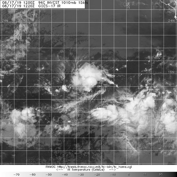
3. Another tropical wave located about 1300 miles west-southwest of
the southern tip of the Baja California peninsula is producing
limited shower and thunderstorm activity.  Environmental conditions
are not expected to be conducive for development while the system
moves slowly westward at about 10 mph during the next couple of
days.
* Formation chance through 48 hours...low...near 0 percent.
* Formation chance through 5 days...low...near 0 percent.
020610hmbzymrmxaik998l.png

霧峰追風者 發表於 2019-8-17 23:40
GFS 預測將侵襲夏威夷,並有機會中颱強度進入西太。 gfs_mslp_pcpn_cpac_48.png gfs_mslp_pcpn_cpac_64.png

本平台僅供學術討論之用,預報應以氣象局為準

威普網站虛擬主機贊助公司

臺灣第一個天氣類型社群平台 即時天氣資訊、精準颱風動態

線上客服
FB傳送訊息
廣告行銷
精準行銷 物超所值
官方粉專
發佈 快速回復 返回頂部 返回列表