|
|
 霧峰追風者|2018-7-27 08:57
|
顯示全部樓層
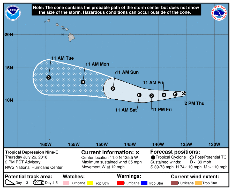
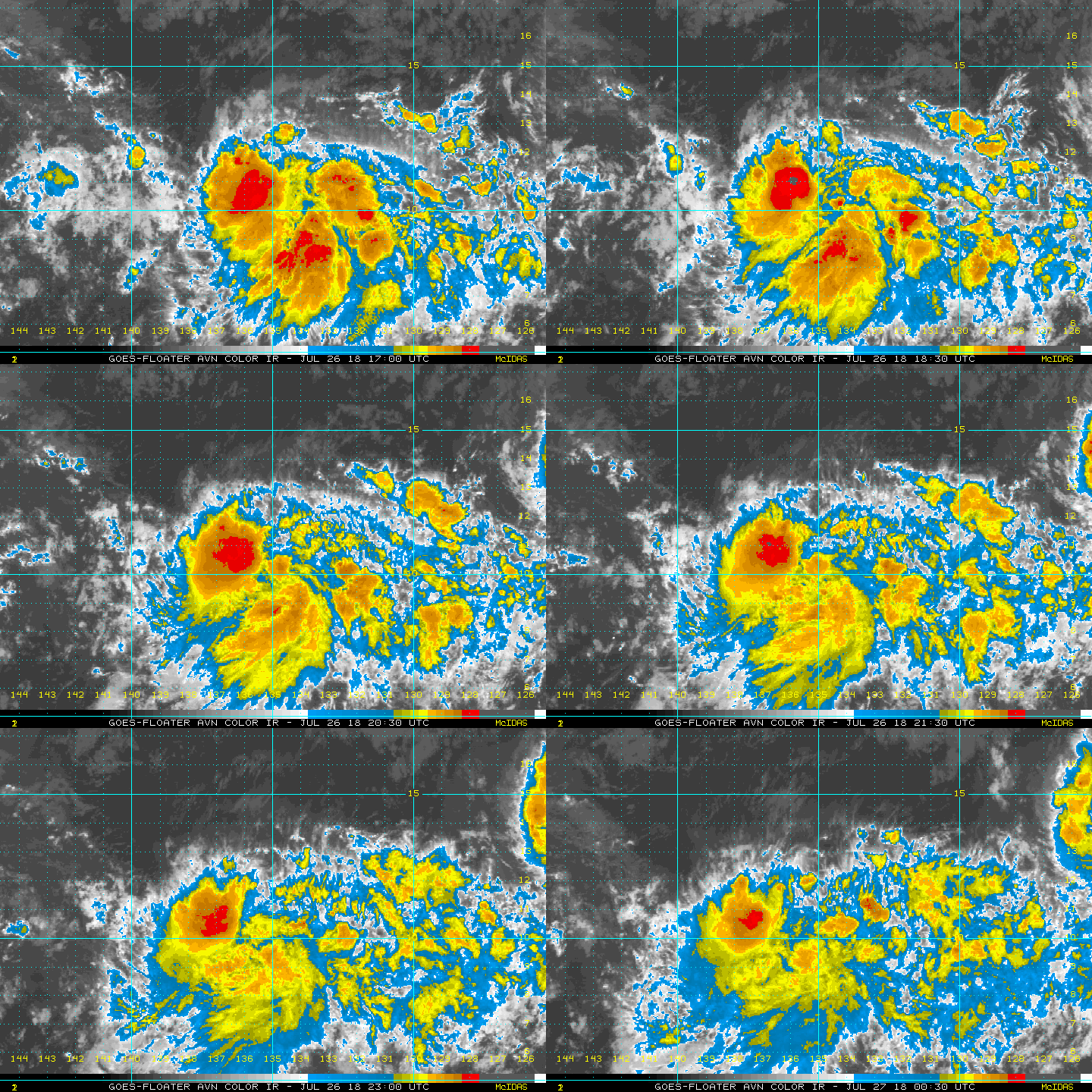
NHC 21Z升格熱帶低壓09E,即將進入中太,不看好命名。
085
WTPZ44 KNHC 262048
TCDEP4
Tropical Depression Nine-E Discussion Number 1
NWS National Hurricane Center Miami FL EP092018
200 PM PDT Thu Jul 26 2018
Satellite data indicate that the low pressure system located over
the far western portion of the eastern Pacific basin has developed
sufficient organization to be classified a tropical depression, the
ninth one of the season and second one of the afternoon. The
initial intensity is set to 30 kt. Although the depression is
expected to be over warm SSTs and in a moist environment during the
next few days, strong northerly shear should prevent strengthening.
The intensity guidance shows little change in strength through the
forecast period, and most of the global models show the system
opening into a trough within the next few days. Based on this
information, the NHC official intensity forecast shows a steady
30-kt depression through the period, but it would not be surprising
if the cyclone dissipated sometime in the forecast period.
The depression is moving to the west at 12 kt steered by the flow
on the south side of a mid-level ridge. This general motion is
expected during the next several days, taking the system into the
central Pacific basin in 24 to 36 hours, and well south of the
Hawaiian Islands in 4 to 5 days. The NHC track forecast lies near
the various consensus models.
FORECAST POSITIONS AND MAX WINDS
INIT 26/2100Z 11.0N 135.5W 30 KT 35 MPH
12H 27/0600Z 10.9N 137.0W 30 KT 35 MPH
24H 27/1800Z 10.8N 139.0W 30 KT 35 MPH
36H 28/0600Z 10.7N 141.2W 30 KT 35 MPH
48H 28/1800Z 10.8N 143.4W 30 KT 35 MPH
72H 29/1800Z 11.8N 148.1W 30 KT 35 MPH
96H 30/1800Z 12.8N 153.4W 30 KT 35 MPH
120H 31/1800Z 13.5N 159.5W 30 KT 35 MPH
$$
Forecaster Cangialosi 

|
|