開啟輔助訪問
 找回密碼
 立即加入

91L 登陸墨西哥

簽到天數: 27 天

[LV.4]偶爾看看III

2019-6-1 10:59 | 顯示全部樓層
  基本資料  
編號    :91 L
擾動編號日期:2019 06 01 10
撤編日期  :2019 06 06 01
AL, 91, 2019053118,   , BEST,   0, 190N,  894W,  15,    0, DB,   0,    ,    0,    0,    0,    0,    0,    0,   0,   0,   0,    ,   0,    ,   0,   0, GENESIS003,  ,  0,    ,    0,    0,    0,    0, genesis-num, 003, SPAWNINVEST, al742019 to al912019,
AL, 91, 2019060100,   , BEST,   0, 194N,  906W,  15, 1008, DB,  34, NEQ,    0,    0,    0,    0, 1009,  100,  90,   0,   0,   L,   0,    ,   0,   0,     INVEST, S,  0,    ,    0,    0,    0,    0, genesis-num, 003,
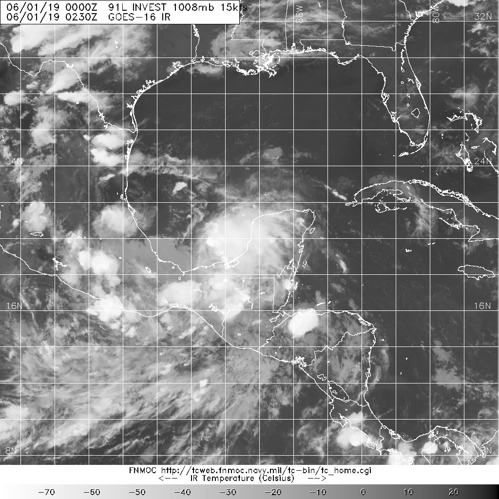
20190601.0230.goes-16.ir.91L.INVEST.15kts.1008mb.19.4N.90.6W.100pc.jpg

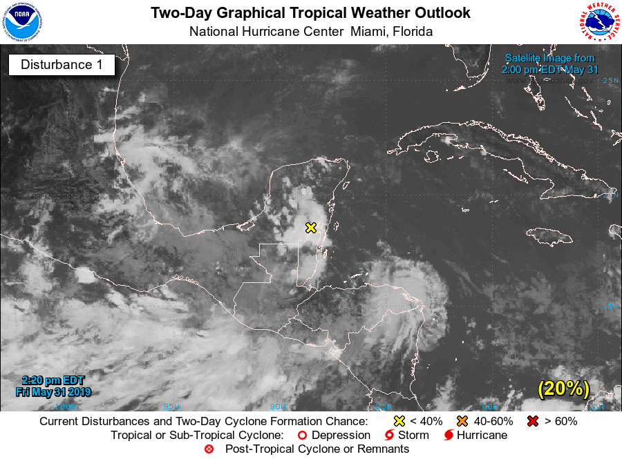
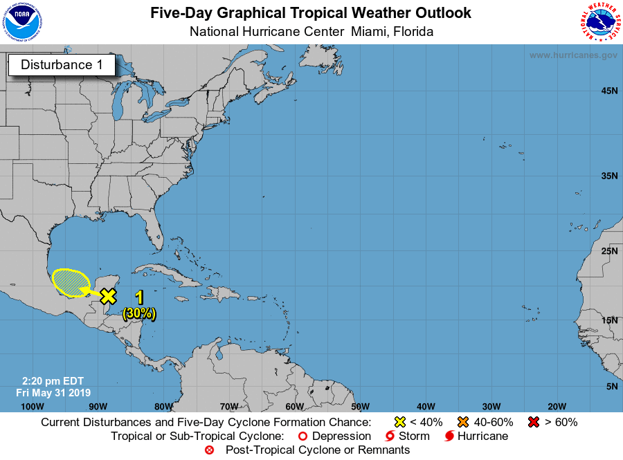
  NHC:20%  
1. A broad area of low pressure accompanied by cloudiness and showers
centered over the Yucatan Peninsula is forecast to move westward
over the southern Bay of Campeche during the weekend.  Some gradual
development of this system is possible through early next week as
long as it remains over water.  Regardless of development, the
disturbance will likely produce heavy rainfall over portions of
southern Mexico during the next few days.  Regular issuance of the
Tropical Weather Outlook will begin at 2 AM EDT tonight with the
beginning of the Atlantic hurricane season.
* Formation chance through 48 hours...low...20 percent.
* Formation chance through 5 days...low...30 percent.
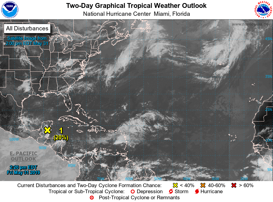
two_atl_2d0.png
two_atl_2d1.png
two_atl_5d1.png

評分

參與人數 1水氣能量 +15 +1 收起 理由
king111807 + 15 + 1 熱帶擾動首帖

查看全部評分

回復

使用道具 舉報

簽到天數: 27 天

[LV.4]偶爾看看III

红豆棒冰冰|2019-6-2 00:25 | 顯示全部樓層
NHC:40%/50%


1. A broad area of low pressure located over the southern Bay of
Campeche is producing disorganized showers and thunderstorms.  The
low is forecast to move westward to west-northwestward across the
southern Bay of Campeche toward the east coast of Mexico during the
next few days.  If the system remains over water, a tropical
depression could form before it moves inland early next week.
Regardless of development, the disturbance will likely produce heavy
rainfall over portions of southern and southeastern Mexico during
the next few days.
* Formation chance through 48 hours...medium...40 percent.
* Formation chance through 5 days...medium...50 percent.

two_atl_2d0.png

two_atl_2d1.png

two_atl_5d1.png

飞机实测计划:

000
NOUS42 KNHC 011425
REPRPD
WEATHER RECONNAISSANCE FLIGHTS
CARCAH, NATIONAL HURRICANE CENTER, MIAMI, FL.
1030 AM EDT SAT 01 JUNE 2019
SUBJECT: TROPICAL CYCLONE PLAN OF THE DAY (TCPOD)
         VALID 02/1100Z TO 03/1100Z JUNE 2019
         TCPOD NUMBER.....19-004

I.  ATLANTIC REQUIREMENTS
    1. SUSPECT AREA (BAY OF CAMPECHE)
       FLIGHT ONE - TEAL 72          FLIGHT TWO - TEAL 73
       A. 02/1900Z                   A. 03/0530Z,1130Z
       B. AFXXX 01BBA INVEST         B. AFXXX 0201A CYCLONE
       C. 02/1600Z                   C. 03/0230Z
       D. 19.0N 95.0W                D. 19.5N 95.5W
       E. 02/1830Z TO 02/2330Z       E. 03/0500Z TO 03/1130Z
       F. SFC TO 10,000 FT           F. SFC TO 10,000 FT

    2. OUTLOOK FOR SUCCEEDING DAY: CONTINUE 6-HRLY FIXES IF SYSTEM
       DEVELOPS AND REMAINS A THREAT.

II. PACIFIC REQUIREMENTS
    1. NEGATIVE RECONNAISSANCE REQUIREMENTS.
    2. OUTLOOK FOR SUCCEEDING DAY.....NEGATIVE.

NOTE:  THIS PRODUCT, THE TCPOD, OUTLINES TASKED NHC, CPHC, AND NCEP
OPERATIONAL WEATHER-RECONNAISSANCE FLYING REQUIREMENTS.  IT WILL BE
ISSUED DAILY NO LATER THAN 1830 UTC THROUGH 30 NOVEMBER BY THE CHIEF,
AERIAL RECONNAISSANCE COORDINATION, ALL HURRICANES (CARCAH) UNIT OF THE
U.S. AIR FORCE RESERVE COMMAND'S 53RD WEATHER RECONNAISSANCE SQUADRON.

$$
SEF

NNNN


回復

使用道具 舉報

快速回覆
您需要登錄後才可以回帖 登錄 | 立即加入

本版積分規則

本平台僅供學術討論之用,預報應以氣象局為準

威普網站虛擬主機贊助公司

臺灣第一個天氣類型社群平台 即時天氣資訊、精準颱風動態

線上客服
FB傳送訊息
廣告行銷
精準行銷 物超所值
官方粉專
發佈 快速回復 返回頂部 返回列表