簽到天數: 1650 天 [LV.Master]伴壇終老
|
 老農民版夜神月|2020-9-22 00:50
|
顯示全部樓層
本帖最後由 老農民版夜神月 於 2020-9-22 04:10 編輯
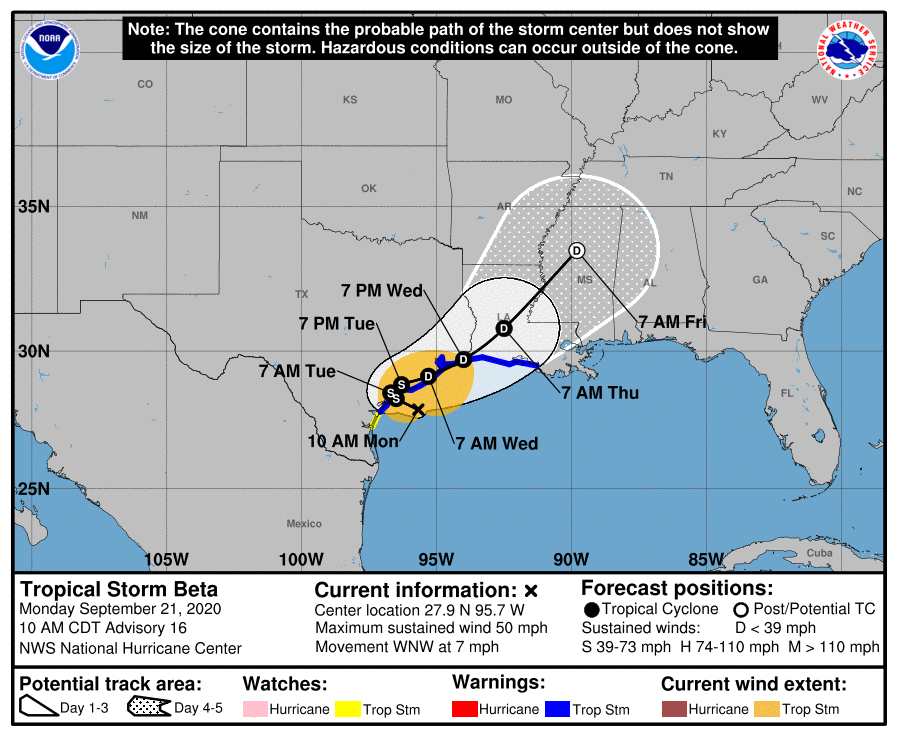
逐漸減弱中,現位於美國南方近海,稍晚將開始在德州近岸滯留一小段時間後登陸AL, 22, 2020092112, 03, OFCL, 3, 279N, 957W, 45, 996, TS, 34, NEQ, 150, 0, 40, 100, 0, 0, 0, 55, 0, , 0, SRS, 290, 6, , , 12, NEQ, 90, 60, 120, 120, AL, 22, 2020092118, 01, CARQ, 0, 281N, 960W, 40, 999, TS, 34, NEQ, 150, 0, 40, 80, 1010, 150, 60, 0, 0, L, 0, X, 300, 6, BETA, M, 000
WTNT42 KNHC 211451
TCDAT2
Tropical Storm Beta Discussion Number 16
NWS National Hurricane Center Miami FL AL222020
1000 AM CDT Mon Sep 21 2020
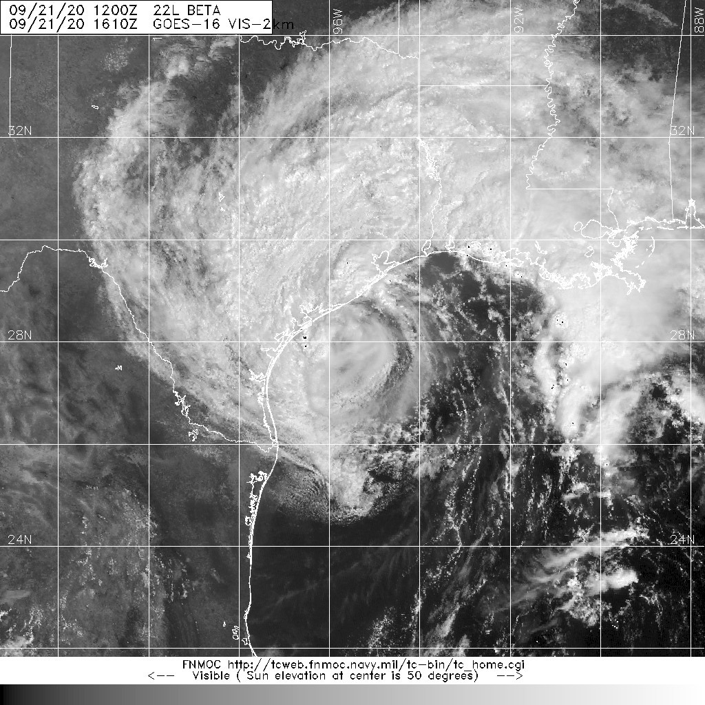
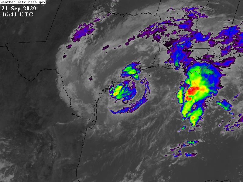
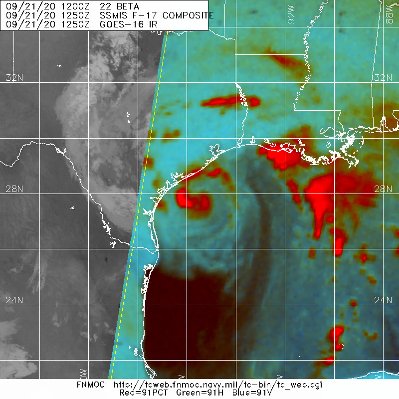
There has been little change in Beta's overall convective structure
and intensity, with thunderstorm activity pulsing near the center
while the outer rain bands have changed little and keep rotating
onshore the central and upper Texas coastal areas. Dry air
intrusions into the inner-core region have continued to prevent
Beta from strengthening by eroding the central dense overcast
(CDO). The initial intensity of 45 kt is based on data from an Air
Force Reserve reconnaissance aircraft showing peak SFMR surface
winds of 40-45 kt and maximum flight-level winds of 50 kt so far,
along with a dropsonde-measured central pressure of 996-997 mb.
Beta now appears to be moving west-northwestward at a slightly
faster forward speed, with the initial motion estimated to be 290/06
kt based on data from the aircraft and NOAA Doppler radars from
Corpus Christi and Houston, Texas. The forecast discussion is the
same old song as it was 24 hours ago with Beta expected to move just
inland over the central Texas coastal Plain in about 12-18 hours,
followed by a sharp decrease in motion, possibly resulting in Beta
stalling for a few hours as steering currents collapse. A trough to
the west combines with a broad ridge to the east located over the
Gulf of Mexico to begin nudging Beta slowly northeastward or
east-northeastward in 24-36 hours, followed by a slightly faster
forward speed on days 3 and 4, which will continue until the cyclone
dissipates over Mississippi by day 5. The new NHC track forecast is
essentially just an update of the previous advisory track, keeping
Beta just inland or near the Texas coast through 60 hours, a
scenario that is close to the various consensus models, and which
lies between the more westward-and-inland ECMWF solution and the
more eastward-and-overwater GFS track forecast.
West-southwesterly vertical wind shear of 15-20 kt is not only
expected to keep Beta's track close to the coastline, but it will
also affect the cyclone's intensity along with land interaction.
The closer the cyclone stays near the Gulf of Mexico, the more
likely that bands of convection containing tropical-storm-force
winds will continue to roll onshore the Texas coast through 36-48
hours. Given that the models over the past 24 hours have been
trending toward a track closer to the coast, the NHC official
intensity remains unchanged from the previous advisory, and lies a
little above all of the available guidance through 48 hours.
Key Messages:
1. The expected slow motion of Beta will produce a long duration
rainfall event from the middle Texas coast to southeast Louisiana.
Flash, urban, and minor river flooding is likely. Rainfall will also
spread northward into the ArkLaTex region and east into the Lower
Mississippi Valley and portions of the Southeast through the end of
the week. Flash, urban, and isolated minor river flooding is
possible.
2. There is the danger of life-threatening storm surge near times of
high tide through Tuesday along portions of the Texas and Louisiana
coasts within the storm surge warning areas. Residents in these
areas should follow advice given by local officials.
3. Tropical-storm-force winds will spread westward across the Texas
coast later this morning and continue into Tuesday.
FORECAST POSITIONS AND MAX WINDS
INIT 21/1500Z 27.9N 95.7W 45 KT 50 MPH
12H 22/0000Z 28.3N 96.5W 45 KT 50 MPH...NEAR TEXAS COAST
24H 22/1200Z 28.5N 96.7W 40 KT 45 MPH...INLAND
36H 23/0000Z 28.8N 96.3W 35 KT 40 MPH...INLAND
48H 23/1200Z 29.1N 95.3W 30 KT 35 MPH...NEAR TEXAS COAST
60H 24/0000Z 29.7N 94.0W 25 KT 30 MPH...NEAR TEXAS COAST
72H 24/1200Z 30.8N 92.5W 25 KT 30 MPH...INLAND
96H 25/1200Z 33.5N 89.8W 20 KT 25 MPH...POST-TROP/INLAND
120H 26/1200Z...DISSIPATED INLAND
$$
Forecaster Stewart


|
|