簽到天數: 3279 天 [LV.Master]伴壇終老
|
 t02436|2016-3-6 00:58
|
顯示全部樓層
BoM編號12U
IDW27600
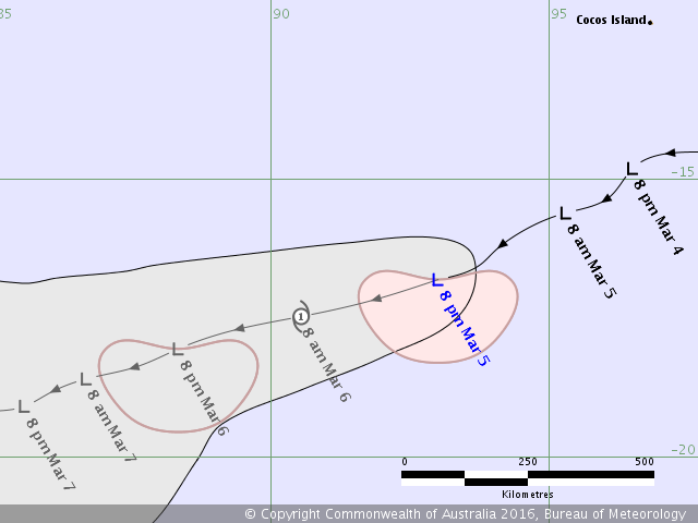
TROPICAL CYCLONE TECHNICAL BULLETIN: AUSTRALIA - WESTERN REGION
Issued by PERTH TROPICAL CYCLONE WARNING CENTRE
at: 1320 UTC 05/03/2016
Name: Tropical Low
Identifier: 12U
Data At: 1200 UTC
Latitude: 16.8S
Longitude: 93.0E
Location Accuracy: within 45 nm [85 km]
Movement Towards: west southwest [241 deg]
Speed of Movement: 12 knots [22 km/h]
Maximum 10-Minute Wind: 35 knots [65 km/h]
Maximum 3-Second Wind Gust: 50 knots [95 km/h]
Central Pressure: 1002 hPa
Radius of 34-knot winds NE quadrant:
Radius of 34-knot winds SE quadrant: 90 nm [165 km]
Radius of 34-knot winds SW quadrant: 90 nm [165 km]
Radius of 34-knot winds NW quadrant:
Radius of 48-knot winds NE quadrant:
Radius of 48-knot winds SE quadrant:
Radius of 48-knot winds SW quadrant:
Radius of 48-knot winds NW quadrant:
Radius of 64-knot winds:
Radius of Maximum Winds: 40 nm [75 km]
Dvorak Intensity Code: T2.0/2.0/D1.0/24HRS STT:S0.0/06HRS
Pressure of outermost isobar: 1006 hPa
Radius of outermost closed isobar: 60 nm [110 km]
FORECAST DATA
Date/Time : Location : Loc. Accuracy: Max Wind : Central Pressure
[UTC] : degrees : nm [km]: knots[km/h]: hPa
+06: 05/1800: 17.2S 91.8E: 055 [105]: 035 [065]: 1000
+12: 06/0000: 17.5S 90.5E: 070 [130]: 040 [075]: 998
+18: 06/0600: 17.7S 89.3E: 080 [150]: 040 [075]: 998
+24: 06/1200: 18.0S 88.3E: 095 [175]: 035 [065]: 1000
+36: 07/0000: 18.6S 86.7E: 115 [210]: 030 [055]: 1002
+48: 07/1200: 19.1S 85.6E: 135 [245]: 025 [045]: 1001
+60: 08/0000: 19.2S 84.3E: 150 [280]: 025 [045]: 1001
+72: 08/1200: 19.3S 82.7E: 170 [320]: 025 [045]: 1002
+96: 09/1200: 19.3S 79.4E: 215 [400]: 025 [045]: 1002
+120: 10/1200: : : :
REMARKS:
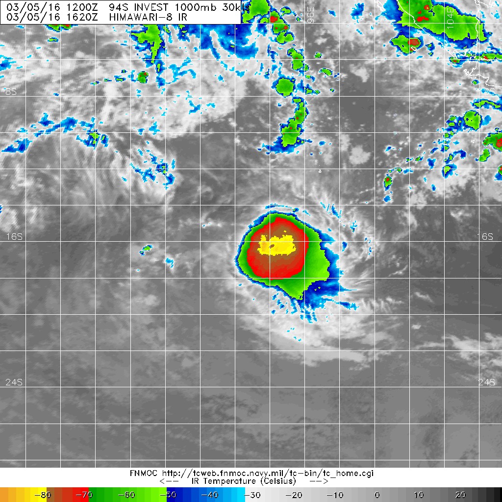
Tropical low 12U [94S] was located using microwave, ASCAT and infra red
satellite imagery.
STTs along the track are in the range 28-29C. CIMMS shear at 12 UTC indicated 10
to 20 knots of shear. There is some poleward outflow.
Dvorak. Initial T1.0 classification was made at 00 UTC 4 March. Curved band wrap
of 0.3 on EIR gave a DT of 2.0. 24 hr trend was D with MET/PAT of 2.0. FT/CI was
2.0. Intensity set to 35 knots in the southeast and southwest quadrants.
ASCAT pass at 0239 UTC showed a small area of 35 knot winds to the southeast of
the centre with 30 knot winds to the south and southeast of the centre. The
centre was elongated with 10 to 15 knot winds in the northwest quadrant.
SSMI microwave image at 0808 UTC and AMSU B at 0822 UTC showed deep convection
to the east of the centre.
NWP is consistent with a general west to southwest track under the influence of
a mid level ridge to the east of the system. Whilst the most likely scenario is
for the system to remain a tropical low with gales in the southeast and
southwest quadrants, there remains a slight risk that the system may develop
into a tropical cyclone around 00 UTC 6 March. During 6 March and particularly 7
March, shear is forecast to increase significantly causing the system to weaken.
The system is likely to pass into La Reunion's area of responsibility between 00
and 06 UTC 6 March.
Copyright Commonwealth of Australia
==
The next bulletin for this system will be issued by: 05/1900 UTC by Perth TCWC.


|
|