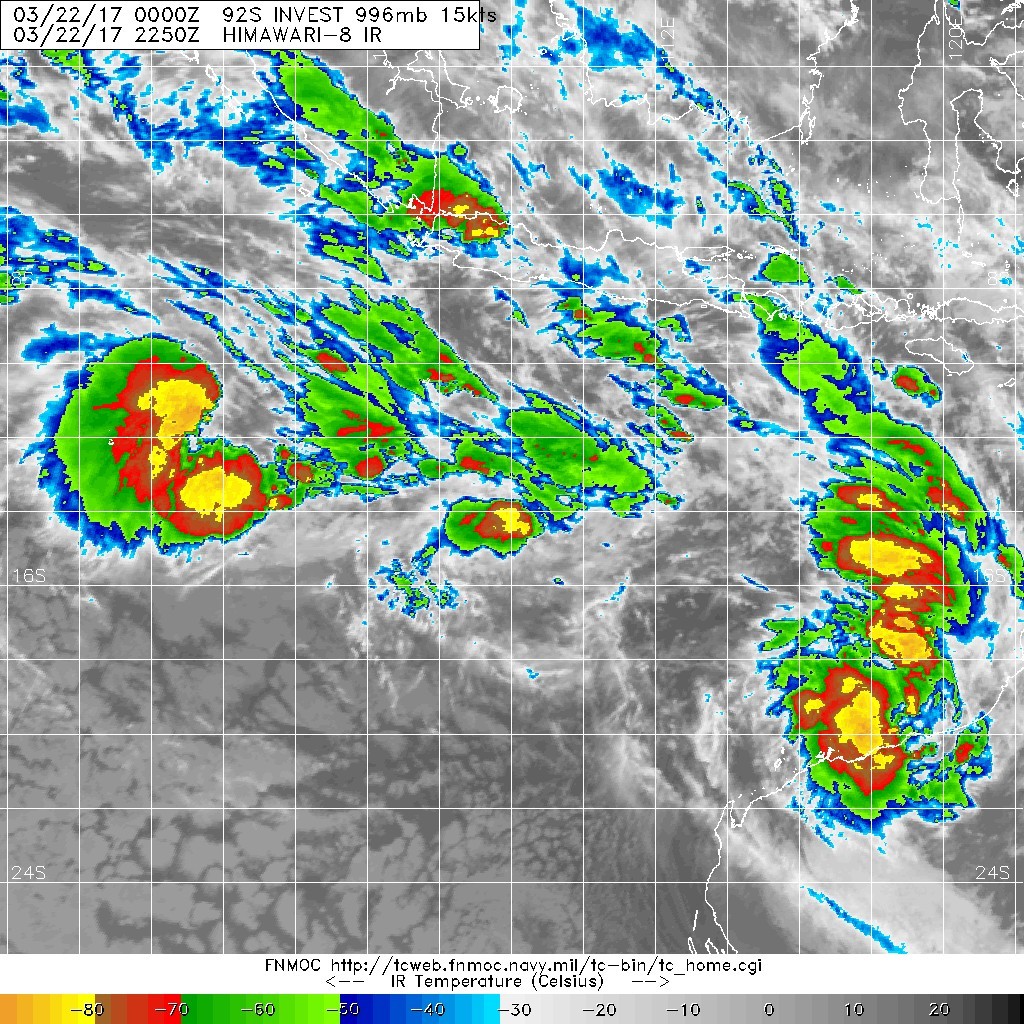
At 2pm WST a small tropical low was located near 15.7S 121.3E (about 270km north northwest of Broome) and was moving slowly east at about 5 km/h. The system is forecast to begin moving southwards later today then west to southwestwards during Sunday and Monday, staying off the WA coast. There is only a small chance that the system develops into a tropical cyclone during Sunday or Monday.
Likelihood of this system being a tropical cyclone in the Western Region on:
Sunday: Low
Monday: Low
Tuesday: Very Low
NOTES: The likelihood is an estimate of the chance of each system being a tropical cyclone in the Region for each day.
Very Low:less than 5%Low:5% to 20%
Moderate:20 to 50%High:Over 50%
The Western Region refers to the Indian Ocean between Longitudes 90-125E and south of 10S.
Further information on Tropical Cyclones is available at www.bom.gov.au/weather/cyclone/
Notice Board
Twitter
Media releases
Severe Weather Update videos
AskBOM videos
Local Infomation
Albany weather
Broome weather
Cocos & Christmas Islands weather
Esperance weather
Giles weather
Geraldton weather
Halls Creek weather
Kalgoorlie-Boulder weather
Learmonth weather
Meekatharra weather
Port Hedland weather
Other Information
Perth - Local Forecast Areas
Fire Weather Forecast Areas
South West Western Australia Fire Weather Forecast Areas
About Weather Forecast Services
About Warning Services
Marine Weather Knowledge Centre
.jpg")