IDW27600
TROPICAL CYCLONE TECHNICAL BULLETIN: AUSTRALIA - WESTERN REGION
Issued by PERTH TROPICAL CYCLONE WARNING CENTRE
at: 1253 UTC 25/01/2019
Name: Tropical Cyclone Riley
Identifier: 12U
Data At: 1200 UTC
Latitude: 16.9S
Longitude: 117.8E
Location Accuracy: within 30 nm [55 km]
Movement Towards: west southwest [258 deg]
Speed of Movement: 5 knots [9 km/h]
Maximum 10-Minute Wind: 50 knots [95 km/h]
Maximum 3-Second Wind Gust: 70 knots [130 km/h]
Central Pressure: 981 hPa
Radius of 34-knot winds NE quadrant: 100 nm [185 km]
Radius of 34-knot winds SE quadrant: 70 nm [130 km]
Radius of 34-knot winds SW quadrant: 70 nm [130 km]
Radius of 34-knot winds NW quadrant: 100 nm [185 km]
Radius of 48-knot winds NE quadrant: 40 nm [75 km]
Radius of 48-knot winds SE quadrant: 40 nm [75 km]
Radius of 48-knot winds SW quadrant: 40 nm [75 km]
Radius of 48-knot winds NW quadrant: 40 nm [75 km]
Radius of 64-knot winds:
Radius of Maximum Winds: 30 nm [55 km]
Dvorak Intensity Code: T3.0/3.5/S0.0/24HRS STT:W0.5/06HRS
Pressure of outermost isobar: 998 hPa
Radius of outermost closed isobar: 100 nm [185 km]
FORECAST DATA
Date/Time : Location : Loc. Accuracy: Max Wind : Central Pressure
[UTC] : degrees : nm [km]: knots[km/h]: hPa
+06: 25/1800: 17.0S 117.3E: 040 [080]: 060 [110]: 974
+12: 26/0000: 17.2S 116.8E: 055 [100]: 060 [110]: 974
+18: 26/0600: 17.5S 116.1E: 065 [125]: 055 [100]: 978
+24: 26/1200: 17.8S 115.3E: 080 [145]: 050 [095]: 982
+36: 27/0000: 18.0S 113.3E: 100 [180]: 045 [085]: 985
+48: 27/1200: 18.3S 111.2E: 120 [220]: 035 [065]: 991
+60: 28/0000: 18.3S 109.0E: 140 [255]: 035 [065]: 991
+72: 28/1200: 18.6S 107.2E: 155 [290]: 030 [055]: 994
+96: 29/1200: 19.4S 103.7E: 200 [370]: 030 [055]: 994
+120: 30/1200: 19.4S 100.5E: 290 [535]: 030 [055]: 993
REMARKS:
Riley's position is based on recent microwave passes and is consistent with
available surface observations.
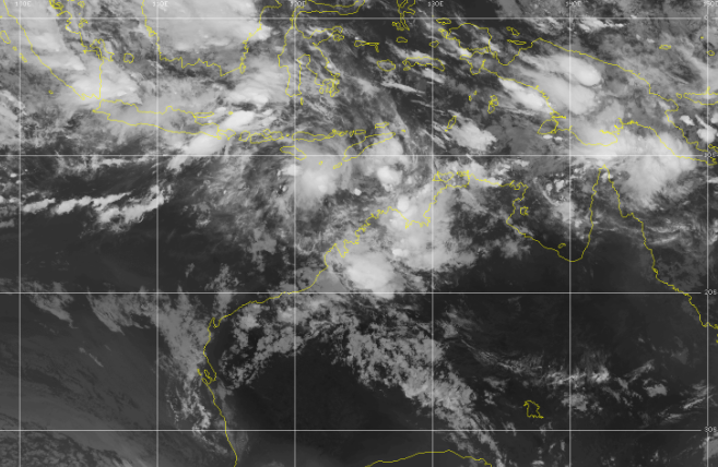
The tropical cyclone has shown signs of weakening over the last few hours.
Microwave imagery showed an exposed low level centre with deep convection
located to the northwest of the centre. EIR imagery shows grately reduced cold
cloud however a new burst of deep convection has appeared to the north of the
centre in the last hour.
The system is still embedded in ample moisture and SSTs are around 29C. It is
under 25-30 knots of easterly shear and satellite imagery would support this.
Shear analysis over the last three hours yields a DT of 3.0. MET is 2.5 based on
W- trend, PAT agrees and FT is set to 3.0 with CI held at 3.5. Scatterometer
passes around 01Z indicated 50 knot winds in northern quadrants, not extending
into southern quadrants. CIMSS ADT is at T3.9 while NESDIS is at T3.8. SATCON
has fluctuated during the day ranging from 66 to 60 to currently 67 knots
[1-minute winds]. Final intensity estimate is set at 50 knots 10-minute mean
wind speed.
Recent movement is towards the west southwest, consistent with model guidance.
The main steering influence is the subtropical ridge over SE Australia. The
forecast track remains generally west southwest during Friday and Saturday. NWP
is in good agreement with this movement. A more southerly track which may take
the system closer to the WA Pilbara coast on Saturday remains a slight chance.
Shear is above 25 knots and may increase further, making rapid intensification
unlikely. While it is possible it may still intensify to Category 3 during the
early hours of Saturday, this is looking unlikely. Increasing vertical wind
shear resulting from the upper ridge moving south away from the system combined
with dry air around the western and northern sectors is forecast to cause
weakening during Saturday and Sunday. A mid-level ridge to the southwest of WA
later in the weekend and early next week is expected to maintain a west
southwest track in the longer term.
Copyright Commonwealth of Australia
==
The next bulletin for this system will be issued by: 25/1930 UTC by Perth TCWC.
IDW27600
TROPICAL CYCLONE TECHNICAL BULLETIN: AUSTRALIA - WESTERN REGION
Issued by PERTH TROPICAL CYCLONE WARNING CENTRE
at: 1917 UTC 24/01/2019
Name: Tropical Cyclone Riley
Identifier: 12U
Data At: 1800 UTC
Latitude: 16.6S
Longitude: 119.0E
Location Accuracy: within 30 nm [55 km]
Movement Towards: west northwest [285 deg]
Speed of Movement: 4 knots [7 km/h]
Maximum 10-Minute Wind: 50 knots [95 km/h]
Maximum 3-Second Wind Gust: 70 knots [130 km/h]
Central Pressure: 985 hPa
Radius of 34-knot winds NE quadrant: 90 nm [165 km]
Radius of 34-knot winds SE quadrant: 60 nm [110 km]
Radius of 34-knot winds SW quadrant: 60 nm [110 km]
Radius of 34-knot winds NW quadrant: 90 nm [165 km]
Radius of 48-knot winds NE quadrant: 30 nm [55 km]
Radius of 48-knot winds SE quadrant: 30 nm [55 km]
Radius of 48-knot winds SW quadrant: 30 nm [55 km]
Radius of 48-knot winds NW quadrant: 30 nm [55 km]
Radius of 64-knot winds:
Radius of Maximum Winds: 20 nm [35 km]
Dvorak Intensity Code: T3.5/3.5/D1.0/24HRS STT:D0.5/06HRS
Pressure of outermost isobar: 1002 hPa
Radius of outermost closed isobar: 110 nm [205 km]
FORECAST DATA
Date/Time : Location : Loc. Accuracy: Max Wind : Central Pressure
[UTC] : degrees : nm [km]: knots[km/h]: hPa
+06: 25/0000: 16.6S 118.6E: 035 [070]: 055 [100]: 979
+12: 25/0600: 16.7S 118.1E: 045 [080]: 060 [110]: 976
+18: 25/1200: 16.8S 117.7E: 055 [105]: 065 [120]: 972
+24: 25/1800: 17.0S 117.2E: 070 [130]: 070 [130]: 969
+36: 26/0600: 17.3S 116.0E: 090 [165]: 070 [130]: 969
+48: 26/1800: 17.6S 114.4E: 110 [200]: 065 [120]: 972
+60: 27/0600: 17.8S 112.5E: 130 [235]: 055 [100]: 979
+72: 27/1800: 18.0S 110.3E: 145 [270]: 045 [085]: 987
+96: 28/1800: 19.1S 106.6E: 190 [355]: 040 [075]: 989
+120: 29/1800: 20.0S 102.9E: 280 [515]: 030 [055]: 995
REMARKS:
Riley's latest position is based on overnight IR imagery along with observations
from Rowley Shoals. Deep convection has consolidated near the centre and covers
the low level centre.
Moderate easterly shear provides a clear shear pattern with the centre 1/3 into
the strong T gradient yielding a DT 0f 3.5. MET is 3.0 based on a D- trend and
PAT is 3.5. FT based on DT/PAT. ADT gives a 1-minute wind speed of 51 knots.
SATCON estimate of 53 knots 1-minute mean wind speed. Current Intensity is 50
knots [10-min mean winds].
Recent movement has been towards the west northwest, however the longer term
trend is to the west southwest, away from the west Kimberley coast. The main
steering influence is the subtropical ridge over SE Australia. The forecast
track remains generally west southwest parallel to the Pilbara coast during
Friday and Saturday. NWP is in good agreement with this movement. A more
southerly track which may take the system closer to the WA Pilbara coast on
Saturday remains a slight chance.
Riley is positioned near the upper level ridge with diffluent outflow
equatorward and poleward. CIMMS analysis shows 20 knots of easterly shear over
the system. The system is surrounded by deep moisture and SSTs are around
29/30C. Conditions are favourable for further development.
A monsoonal surge combined with dual outflow pattern suggests that rapid
intensification is also possible in the next 24 to 36 hours. Peak intensity of
70 knots is forecast during Saturday. Increasing vertical wind shear resulting
from the upper ridge moving south away from the system combined with dry air
around the western and northern sectors is forecast to prevent further
intensification from late Saturday or early Sunday. A mid-level ridge to the
southwest of WA later in the weekend and early next week is expected to maintain
a west southwest track in the longer term.
Copyright Commonwealth of Australia
==
The next bulletin for this system will be issued by: 25/0130 UTC by Perth TCWC.
WTXS22 PGTW 230730
MSGID/GENADMIN/JOINT TYPHOON WRNCEN PEARL HARBOR HI//
SUBJ/TROPICAL CYCLONE FORMATION ALERT//
REF/A/JOINT TYPHOON WRNCEN PEARL HARBOR HI/222230Z JAN 19//
AMPN/REF IS TROPICAL CYCLONE FORMATION ALERT (WTXS21 PGTW 222230)//
RMKS/
1. FORMATION OF A SIGNIFICANT TROPICAL CYCLONE IS POSSIBLE WITHIN
160 NM EITHER SIDE OF A LINE FROM 14.1S 124.0E TO 16.9S 118.5E
WITHIN THE NEXT 12 TO 24 HOURS. AVAILABLE DATA DOES NOT JUSTIFY
ISSUANCE OF NUMBERED TROPICAL CYCLONE WARNINGS AT THIS TIME. WINDS
IN THE AREA ARE ESTIMATED TO BE 25 TO 30 KNOTS. METSAT IMAGERY AT
230700Z INDICATES THAT A CIRCULATION CENTER IS LOCATED NEAR 14.7S
123.7E. THE SYSTEM IS MOVING SOUTH-SOUTHWESTWARD AT 11 KNOTS.
2. REMARKS: THE AREA OF CONVECTION (INVEST 94S) PREVIOUSLY LOCATED
NEAR 11.4S 126.6E, IS NOW LOCATED NEAR 14.7S 123.7E, APPROXIMATELY
210 NM NORTH-NORTHEAST OF BROOME, AUSTRALIA. ANIMATED MULTISPECTRAL
SATELLITE IMAGERY AND A 230508Z AMSR2 89GHZ MICROWAVE IMAGE SHOW
CURVED BANDING WRAPPING INTO A CONSOLIDATING LOW LEVEL CIRCULATION.
THE DISTURBANCE IS CURRENTLY LOCATED IN AN AREA OF STRONG RADIAL
OUTFLOW, LOW VERTICAL WIND SHEAR (10-15 KNOTS), AND WARM SEA SURFACE
TEMPERATURES (28-30 CELSIUS). GLOBAL MODELS INDICATE A GENERALLY
WEST-SOUTHWESTWARD TRACK WITH STEADY INTENSIFICATION OVER THE NEXT
24 HOURS. MAXIMUM SUSTAINED SURFACE WINDS ARE ESTIMATED AT 25 TO 30
KNOTS. MINIMUM SEA LEVEL PRESSURE IS ESTIMATED TO BE NEAR 1000 MB.
THE POTENTIAL FOR THE DEVELOPMENT OF A SIGNIFICANT TROPICAL CYCLONE
WITHIN THE NEXT 24 HOURS IS HIGH.
3. THIS ALERT WILL BE REISSUED, UPGRADED TO WARNING OR CANCELLED BY
240730Z.
4. SEE REF A (WTXS21 PGTW 222230) FOR DETAILS ON A TROPICAL CYCLONE
FORMATION ALERT LOCATED NEAR 20.5S 40.5E.//
NNNN
IDW27600
TROPICAL CYCLONE TECHNICAL BULLETIN: AUSTRALIA - WESTERN REGION
Issued by DARWIN TROPICAL CYCLONE WARNING CENTRE
at: 0132 UTC 23/01/2019
Name: Tropical Low
Identifier: 12U
Data At: 0000 UTC
Latitude: 13.8S
Longitude: 124.2E
Location Accuracy: within 45 nm [85 km]
Movement Towards: southwest [216 deg]
Speed of Movement: 9 knots [17 km/h]
Maximum 10-Minute Wind: 25 knots [45 km/h]
Maximum 3-Second Wind Gust: 45 knots [85 km/h]
Central Pressure: 1000 hPa
Radius of 34-knot winds NE quadrant:
Radius of 34-knot winds SE quadrant:
Radius of 34-knot winds SW quadrant:
Radius of 34-knot winds NW quadrant:
Radius of 48-knot winds NE quadrant:
Radius of 48-knot winds SE quadrant:
Radius of 48-knot winds SW quadrant:
Radius of 48-knot winds NW quadrant:
Radius of 64-knot winds:
Radius of Maximum Winds:
Dvorak Intensity Code: T2.0/2.0/D1.0/24HRS STT:D0.5/06HRS
Pressure of outermost isobar: 1004 hPa
Radius of outermost closed isobar: 120 nm [220 km]
FORECAST DATA
Date/Time : Location : Loc. Accuracy: Max Wind : Central Pressure
[UTC] : degrees : nm [km]: knots[km/h]: hPa
+06: 23/0600: 14.3S 123.6E: 040 [080]: 025 [045]: 1002
+12: 23/1200: 14.6S 123.1E: 055 [100]: 030 [055]: 999
+18: 23/1800: 15.2S 121.9E: 065 [125]: 030 [055]: 1000
+24: 24/0000: 15.5S 121.1E: 080 [145]: 035 [065]: 997
+36: 24/1200: 15.5S 120.0E: 100 [185]: 040 [075]: 993
+48: 25/0000: 15.9S 119.4E: 120 [220]: 050 [095]: 987
+60: 25/1200: 16.8S 118.4E: 140 [255]: 055 [100]: 987
+72: 26/0000: 17.2S 117.0E: 155 [290]: 065 [120]: 984
+96: 27/0000: 18.2S 114.3E: 200 [370]: 065 [120]: 974
+120: 28/0000: 19.2S 110.6E: 290 [535]: 060 [110]: 978
REMARKS:
Position is fair, based on a TC SSMIS 2135Z image, which shows a broad circular
system with a strong convective band to the east and weaker curvature to the
southwest. Recent satellite imagery show a strong area of deep convection
obscuring the LLCC.
Dvorak initial classification [T1.0] was assigned at 00Z Tue 22 Jan. FT at 00Z
Wed 23 Jan is 2.0 based on MET. DT could not be assigned. Browse Island AWS, to
the southwest of the system, has reported sustained 15-20 kt during the last few
hours. Intensity set at 25kt. Objective aids are not yet available.
12U is positioned near the upper level ridge. Outflow is predominantly to the
south but there is a weaker outflow channel also to the north. CIMSS wind shear
at 18UTC indicated low 10-15kt wind shear over the system. 12U is surrounded by
deep moisture. SSTs are around 29C.
The forecast track is to the SW, north of and parallel to the WA coastline,
guided by a mid-level ridge over southern Australia. NWP is in good agreement
with this movement.
Intensity is based on a standard development trend for the next 24 hours, with
TC intensity forecast for 00Z Thu. An ASCAT pass at 1255 UTC last night shows a
strong 25-35 knot monsoonal surge moving through the Indonesian archipelego,
which is expected to feed into the system tonight. The combination of the surge
and dual outflow suggests intensification could be slightly faster. Beyond the
next 24 hours, wind shear is forecast to remain low through Thu allowing the
system to continue to intensity. The dominant outflow channel will be to the
west and therefore in the absence of a persistent dual outflow channel, rapid
intensification becomes less likely. Peak intensity of 65 knots is forecast from
00Z Sat 26 Jan. Upper level winds are forecast to increase over the system from
Fri, which may increase the vertical wind shear over the system. From Sun, dry
air may begins to advect around the western and northern sectors, possibly
limiting the moist inflow. The TC is forecast to begin weakening over water from
Mon 28 Jan and below TC intensity by Tue 29 Jan.
Copyright Commonwealth of Australia
==
The next bulletin for this system will be issued by: 23/0730 UTC by Darwin TCWC.