Tropical Storm Andres Discussion Number 2
NWS National Hurricane Center Miami FL EP012021
900 AM MDT Sun May 09 2021
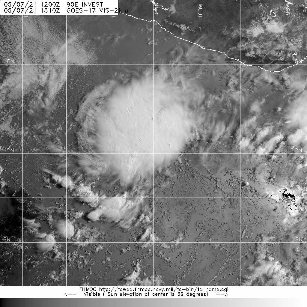
Although the system lacks well-defined convective banding features,
Dvorak intensity estimates from both TAFB and SAB are 35 kt.
This is consistent with a data T-number based on a shear pattern
with the low-level center displaced within 3/4 degrees to the west
of the edge of the main area of deep convection, as suggested by
recent microwave imagery. Since earlier scatterometer data
indicated that the system was close to tropical storm strength,
and given the latest Dvorak analyses, the cyclone is being named. Andres is the earliest tropical storm on record in the eastern
North Pacific basin, just beating out Adrian of 2017.
Increasing southwesterly to westerly shear and drier air to the
west of the cyclone should prevent any significant additional
strengthening. The official forecast generally follows the
numerical guidance and shows the system degenerating into a remnant
low in 48 hours, as in the previous advisory.
The initial motion is slowly northwestward, or 325/5. Andres
should move along the southwestern side of a low- to mid-level
ridge for the next couple of days and turn westward in the
low-level flow as an increasingly shallow circulation. The
official track forecast is on the southern side of the model
guidance suite. This also close to the latest latest corrected
consensus, or HCCA, track.
TROPICAL DEPRESSION ONE-E FORECAST/ADVISORY NUMBER 1
NWS NATIONAL HURRICANE CENTER MIAMI FL EP012021
0900 UTC SUN MAY 09 2021
THERE ARE NO COASTAL WATCHES OR WARNINGS IN EFFECT.
TROPICAL DEPRESSION CENTER LOCATED NEAR 13.8N 107.7W AT 09/0900Z
POSITION ACCURATE WITHIN 25 NM
PRESENT MOVEMENT TOWARD THE NORTHWEST OR 325 DEGREES AT 4 KT
ESTIMATED MINIMUM CENTRAL PRESSURE 1006 MB
MAX SUSTAINED WINDS 30 KT WITH GUSTS TO 40 KT.
WINDS AND SEAS VARY GREATLY IN EACH QUADRANT. RADII IN NAUTICAL
MILES ARE THE LARGEST RADII EXPECTED ANYWHERE IN THAT QUADRANT.
REPEAT...CENTER LOCATED NEAR 13.8N 107.7W AT 09/0900Z
AT 09/0600Z CENTER WAS LOCATED NEAR 13.6N 107.6W
FORECAST VALID 09/1800Z 14.5N 108.1W
MAX WIND 35 KT...GUSTS 45 KT.
34 KT... 60NE 0SE 0SW 0NW.
FORECAST VALID 10/0600Z 15.3N 108.6W
MAX WIND 35 KT...GUSTS 45 KT.
34 KT... 60NE 0SE 0SW 0NW.
FORECAST VALID 10/1800Z 15.8N 109.2W
MAX WIND 30 KT...GUSTS 40 KT.
FORECAST VALID 11/0600Z 16.1N 110.0W...POST-TROP/REMNT LOW
MAX WIND 25 KT...GUSTS 35 KT.
FORECAST VALID 11/1800Z 16.2N 110.9W...POST-TROP/REMNT LOW
MAX WIND 25 KT...GUSTS 35 KT.
FORECAST VALID 12/0600Z 16.2N 112.2W...POST-TROP/REMNT LOW
MAX WIND 20 KT...GUSTS 30 KT.
EXTENDED OUTLOOK. NOTE...ERRORS FOR TRACK HAVE AVERAGED NEAR 100 NM
ON DAY 4 AND 125 NM ON DAY 5...AND FOR INTENSITY NEAR 15 KT EACH DAY
OUTLOOK VALID 13/0600Z 15.8N 115.0W...POST-TROP/REMNT LOW
MAX WIND 20 KT...GUSTS 30 KT.
OUTLOOK VALID 14/0600Z...DISSIPATED
REQUEST FOR 3 HOURLY SHIP REPORTS WITHIN 300 MILES OF 13.8N 107.7W