|
本帖最後由 krichard2011 於 2014-8-5 07:53 編輯 Uh.. 雖然是實測 但這個結構真的讓我很懷疑 這真的值70KT嗎 = = 結構真是糟到一個不行... 會有這麼強的風 個人推測可能是與東方的高壓產生的的氣壓梯度所造成的 |
|
看起來不怎麼樣,可是 NHC 已升格 Bertha 為一級颶風。 000 WTNT43 KNHC 041439 TCDAT3 HURRICANE BERTHA DISCUSSION NUMBER 15 NWS NATIONAL HURRICANE CENTER MIAMI FL AL032014 1100 AM EDT MON AUG 04 2014 In spite of its unimpressive appearance on satellite imagery, with scant evidence of banding features and relatively disorganized deep convection, aerial reconnaissance data indicate that Bertha has intensified into a hurricane. Flight-level, dropsonde, and SFMR winds from Air Force and NOAA Hurricane Hunter planes support an intensity of 70 kt for this advisory. Bertha does have well-defined anticyclonic upper-level outflow over the eastern and southern portions of the circulation. Recent infrared imagery shows warming cloud tops, so the intensity is probably leveling off. Dynamical guidance predicts a very large increase in shear beginning in 24-36 hours, and a weakening trend is forecast to begin around that time. In about 72 hours, the global models show the cyclone interacting with a baroclinic zone in the vicinity of Newfoundland, so the NHC forecast shows Bertha becoming extratropical by that time. Center fixes from the Hurricane Hunter aircraft indicate that the motion is now 360/15 kt. The track forecast remains relatively straightforward. Over the next couple of days, Bertha should turn toward the northeast and accelerate in the flow between a mid-tropospheric anticyclone over the southwestern Atlantic and a broad trough moving off the United States east coast. Later in the forecast period, the cyclone should continue moving quickly to the northeast or east-northeast within the mid-latitude westerlies. The official forecast track is not much different from the previous one, and close to the dynamical model consensus. FORECAST POSITIONS AND MAX WINDS INIT 04/1500Z 27.6N 73.6W 70 KT 80 MPH 12H 05/0000Z 30.0N 73.4W 70 KT 80 MPH 24H 05/1200Z 33.4N 72.1W 70 KT 80 MPH 36H 06/0000Z 36.3N 69.3W 65 KT 75 MPH 48H 06/1200Z 39.0N 65.0W 60 KT 70 MPH 72H 07/1200Z 45.0N 55.0W 55 KT 65 MPH...POST-TROP/EXTRATROP 96H 08/1200Z 49.0N 45.0W 50 KT 60 MPH...POST-TROP/EXTRATROP 120H 09/1200Z 49.0N 33.0W 40 KT 45 MPH...POST-TROP/EXTRATROP $$ Forecaster Pasch |
|
目前從色調強化來看 對流還算集中 NHC預測從美國外海通過 強度上看 Cat.1 INIT 04/0300Z 24.9N 73.2W 55 KT 65 MPH 12H 04/1200Z 27.3N 73.7W 60 KT 70 MPH 24H 05/0000Z 30.8N 73.4W 65 KT 75 MPH 36H 05/1200Z 34.1N 72.0W 65 KT 75 MPH 48H 06/0000Z 36.9N 69.0W 65 KT 75 MPH 72H 07/0000Z 42.2N 59.5W 60 KT 70 MPH 96H 08/0000Z 47.5N 50.0W 50 KT 60 MPH...POST-TROP/EXTRATROP 120H 09/0000Z 49.5N 40.0W 50 KT 60 MPH...POST-TROP/EXTRATROP |
|
NHC持續維持HIGH 目前這系統似乎成現裸奔狀態 似乎暫時受到風切影響 估計要走到西經50度附近應該才會有比較好一點的發展 不過附近的乾空氣還是一大考驗 = = |
|
整個大西洋乾得不得了 這系統的對流都幾乎消散了 = = 不過GFS數值還是看好未來成旋 NHC 持續維持HIGH 70% |
|
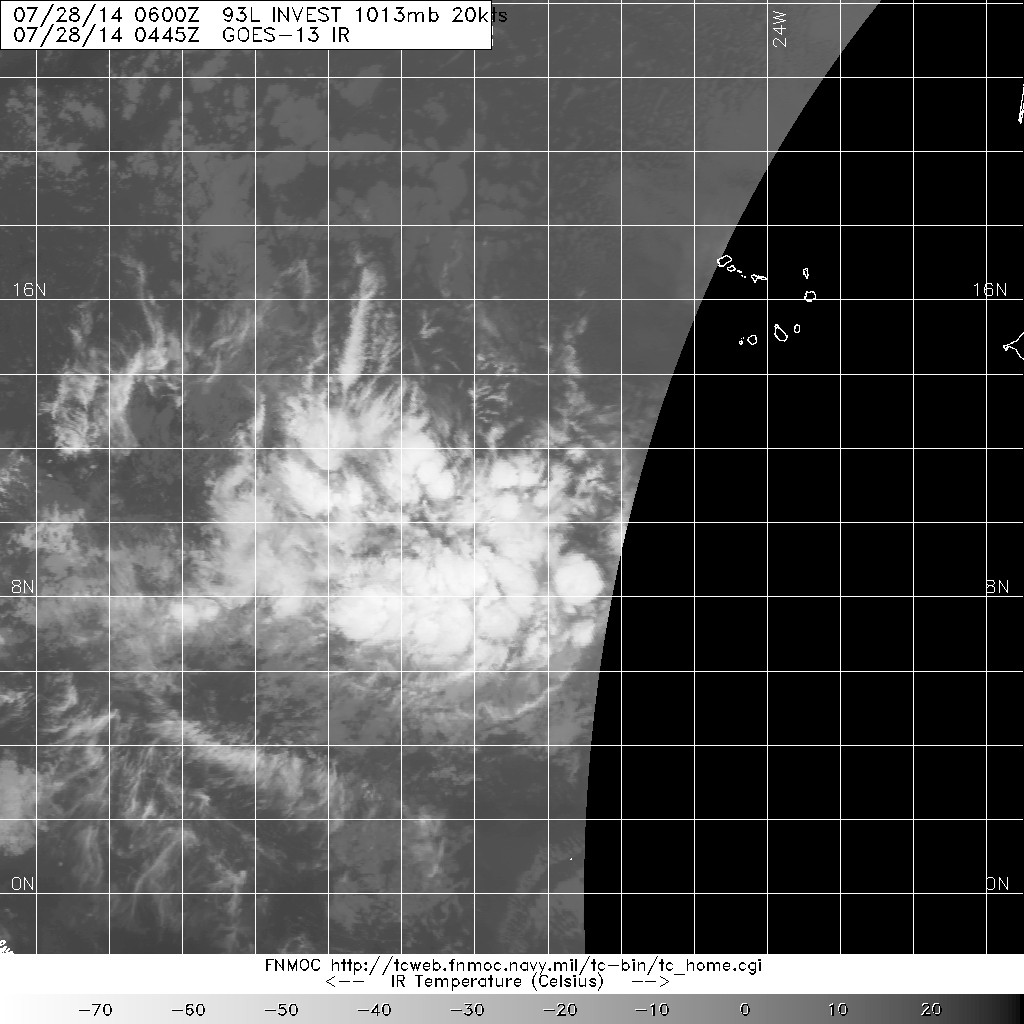
NHC升評Medium 五天生成機率高達70% 樣子大致上還算不錯 GFS支持發展 TROPICAL WEATHER OUTLOOK NWS NATIONAL HURRICANE CENTER MIAMI FL 200 AM EDT MON JUL 28 2014 For the North Atlantic...Caribbean Sea and the Gulf of Mexico: 1. A tropical wave located about 550 miles southwest of the Cape Verde Islands is producing a large area of cloudiness and thunderstorms. Shower activity has increased and become a little better organized during the past several hours, and environmental conditions are expected to be conducive for additional development of this disturbance over the next several days while it moves generally westward at 10 to 15 mph. * Formation chance through 48 hours...medium...30 percent. * Formation chance through 5 days...high...70 percent. |