簽到天數: 3279 天 [LV.Master]伴壇終老
|
 t02436|2017-3-28 14:56
|
顯示全部樓層
中心已經在04Z前後登陸昆士蘭,強度減弱為澳式C3。TROPICAL CYCLONE ADVICE NUMBER 47
Issued at 3:58 pm EST on Tuesday 28 March 2017
Headline:
Debbie now category 3 as it moves slowly inland.
Areas Affected:
Warning Zone
Townsville to St Lawrence, including Mackay, and the Whitsunday Islands, extending inland to Charters Towers, Mount Coolon, Moranbah, and Pentland.
Watch Zone
None.
Cancelled Zone
None.
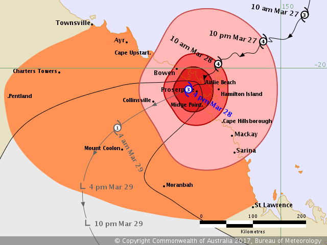
Details of Severe Tropical Cyclone Debbie at 4:00 pm AEST:
Intensity: Category 3, sustained winds near the centre of 150 kilometres per hour with wind gusts to 205 kilometres per hour.
Location: within 30 kilometres of 20.4 degrees South 148.4 degrees East, estimated to be 45 kilometres south southeast of Bowen and 15 kilometres west northwest of Proserpine.
Movement: southwest at 12 kilometres per hour.
Severe tropical cyclone Debbie is a category 3 cyclone. The system is forecast to move slowly southwest over the next 12 to 18 hours before curving to a more southerly track over inland Queensland. The cyclone made landfall near Airlie Beach around midday and has started weakening as it moves slowly inland. The system is expected to move further inland this afternoon and evening, and the peak winds near the centre will weaken rapidly. However, heavy rain is expected to continue across the region.
Significant wind gust observations include:
- 262 km/h at Hamilton Island airport at 10:30 am
- 165 km/h at Proserpine Airport 12:57 am
- 148 km/h at Bowen Airport at 2:24 pm
Hazards:
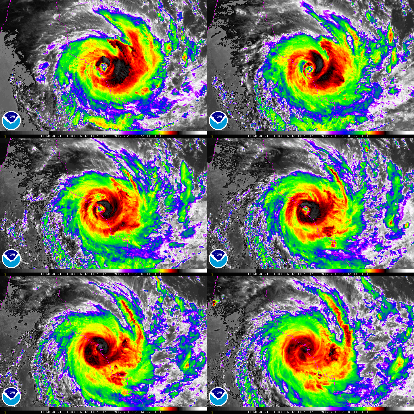
The VERY DESTRUCTIVE CORE of severe tropical cyclone Debbie is impacting the Whitsunday Islands and the nearby mainland. The centre of the system is now over land, north of Proserpine. The wind gusts may still reach 205 km/h near the centre for the next hour.
DESTRUCTIVE WINDS with gusts over 125 km/h are occurring about the coast and islands between about Cape Upstart and Cape Hillsborough (north of Mackay), including Bowen and Proserpine, and may extend further west along the coast to Ayr during this afternoon. These DESTRUCTIVE WINDS may extend to adjacent inland areas, including Collinsville, and Mount Coolon later today into this evening. Destructive winds are no longer expected in Townsville, Charters Towers, Mackay or Sarina.
GALES are occurring about the coast and islands between about Cape Bowling Green and St Lawrence. These GALES are expected to extend westwards to Townsville and inland to locations such as Charters Towers, Pentland, Mount Coolon, and Moranbah this afternoon and evening.
Abnormally high tides are expected between Bowen and St Lawrence. Large waves may produce minor flooding along the foreshore. People living in areas likely to be affected by this flooding should take measures to protect their property as much as possible and be prepared to help their neighbours.
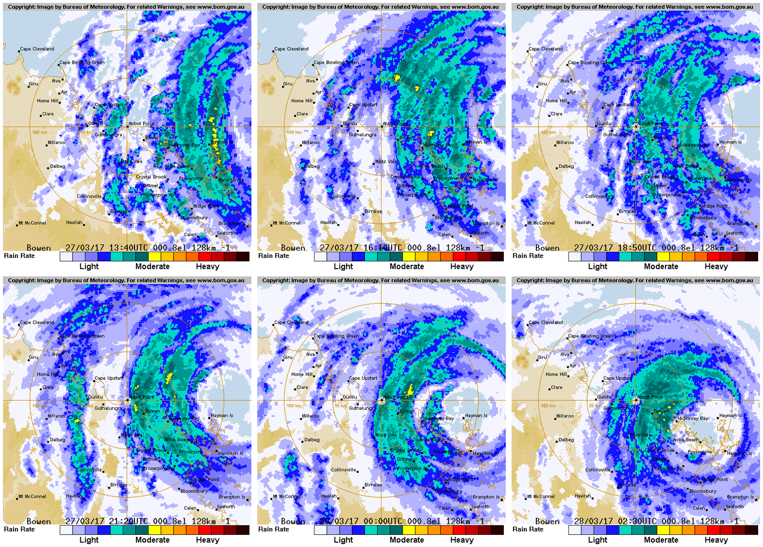
Areas of heavy rain with the potential to cause severe flash flooding have developed around the Central Coast and Whitsundays district. These heavy rain areas are expected to spread further inland through central and southeastern Queensland. Widespread daily rainfall totals of 150 to 250 mm are expected, with significantly higher totals possible locally. This is likely to lead to major river flooding over a broad area this week, and a Flood Watch for coastal catchments between Ayr and the NSW border, extending inland to parts of the Central Highlands and Coalfields, Central West, Maranoa and Warrego, and Darling Downs and Granite Belt forecast districts.
Recommended Action:
- People in the path of the very dangerous cyclone should stay calm and remain in a secure shelter - above the expected water level - while the very destructive winds continue.
- Do not venture outside if you find yourself in the eye of the cyclone - very destructive winds from a different direction could resume at any time.
- Follow the evacuation advice or directions of Police, Emergency Services personnel and local authorities.
People elsewhere along the coast between Ayr and Townsville and inland areas, including Collinsville, Charters Towers, Pentland and Moranbah, should complete preparations quickly and be prepared to shelter in a safe place.
- Boats and outside property should be secured.
- For cyclone preparedness and safety advice, visit Queensland's Disaster Management Services website (www.disaster.qld.gov.au)
- For emergency assistance call the Queensland State Emergency Service on 132 500 (for assistance with storm damage, rising flood water, fallen trees on buildings or roof damage).
Next Advice:
The next advice will be issued by 5:00 pm AEST Tuesday 28 March.
This warning is also available through TV and Radio Broadcasts; the Bureau's website at www.bom.gov.au or call 1300 659 212. The Bureau and the State Emergency Service would appreciate this warning being broadcast regularly.


|
|