開啟輔助訪問
 找回密碼
 立即加入

14E.Lane 實測猛爆上C5 中太12年最強颶風

簽到天數: 3279 天

[LV.Master]伴壇終老

t02436|2018-8-15 23:48 | 顯示全部樓層
15Z命名Lane,暫時上望105節。
781
WTPZ44 KNHC 151452
TCDEP4

Tropical Storm Lane Discussion Number   3
NWS National Hurricane Center Miami FL       EP142018
800 AM PDT Wed Aug 15 2018

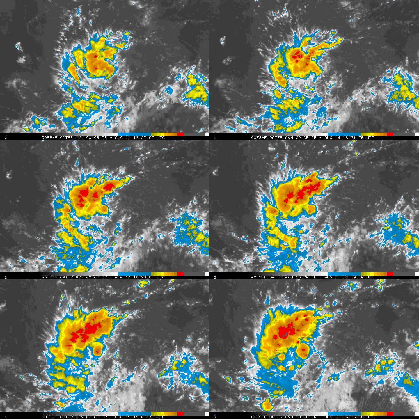
The latest satellite imagery shows that the cyclone continues to
become better organized with a growing central dense overcast along
with ample banding features.  Dvorak estimates range from 30 to 40
kt, and with the increased organization since the last advisory,
the initial wind speed is set to 35 kt.

Further intensification is likely over the next few days as Lane
encounters a conducive large-scale environment consisting of low
shear and fairly warm waters.  Rapid strengthening is a distinct
possibility after the cyclone forms an inner core, which could take
a day or so given that there is still some drier air in the eastern
semicircle.  The DTOPS rapid intensification index indicates a high
probability of significant strengthening over the next 3 days, with
over a 70 percent chance of a 65-kt increase during that time.
Given that some of the guidance (FSSE and HMON) are even higher than
that, this seems like a reasonable forecast and is indicated below.
The new NHC forecast is raised from the last advisory, and is close
to a blend of the previous forecast and the corrected-consensus
guidance.  Continuity prevents a higher forecast, but Lane seems
destined to eventually become a category-4 hurricane like Hector.

The storm continues to move just south of due west at about 12 kt.
The subtropical ridge to the north of Lane is forecast to weaken
slightly over the next few days, which will likely steer the cyclone
to the west or west-northwest throughout the period.  There is very
little spread in the guidance, with the most notable change since
the last advisory being a small shift to the southwest.  The
latest official track forecast is adjusted in that direction, and is
not too far from the latest model consensus.  Given the tightly
packed guidance, this appears to be a high-confidence forecast.


FORECAST POSITIONS AND MAX WINDS

INIT  15/1500Z 10.7N 123.6W   35 KT  40 MPH
12H  16/0000Z 10.6N 125.5W   45 KT  50 MPH
24H  16/1200Z 10.7N 127.7W   55 KT  65 MPH
36H  17/0000Z 11.0N 130.0W   70 KT  80 MPH
48H  17/1200Z 11.5N 132.4W   85 KT 100 MPH
72H  18/1200Z 12.6N 137.6W  100 KT 115 MPH
96H  19/1200Z 13.9N 142.2W  105 KT 120 MPH
120H  20/1200Z 15.0N 146.5W  105 KT 120 MPH

$$
Forecaster Blake

145223_5day_cone_with_line.png

GOES15002018227ZGaIB3.jpg
回復

使用道具 舉報

簽到天數: 35 天

[LV.5]常住居民I

傳奇@天氣人|2018-8-15 19:42 來自手機 | 顯示全部樓層
霧峰追風者 發表於 2018-8-15 11:45
NHC 升格熱帶低壓14E,預測進入中太達二級颶風。

有機會到西太平洋嗎?

點評

現在來看可能進入西太前就GG了  發表於 2018-8-19 13:36
看數值15天後有機會進入西太,不過變動性很大。  發表於 2018-8-16 10:48
字數未滿20字請善用點評功能唷,手機板的可用chrome瀏覽器跳電腦版就能點評囉  發表於 2018-8-16 01:13
現在還太早,變數很大。  發表於 2018-8-15 22:36
回復

使用道具 舉報

簽到天數: 601 天

[LV.9]以壇為家II

霧峰追風者|2018-8-15 11:45 | 顯示全部樓層
NHC 升格熱帶低壓14E,預測進入中太達二級颶風。
191
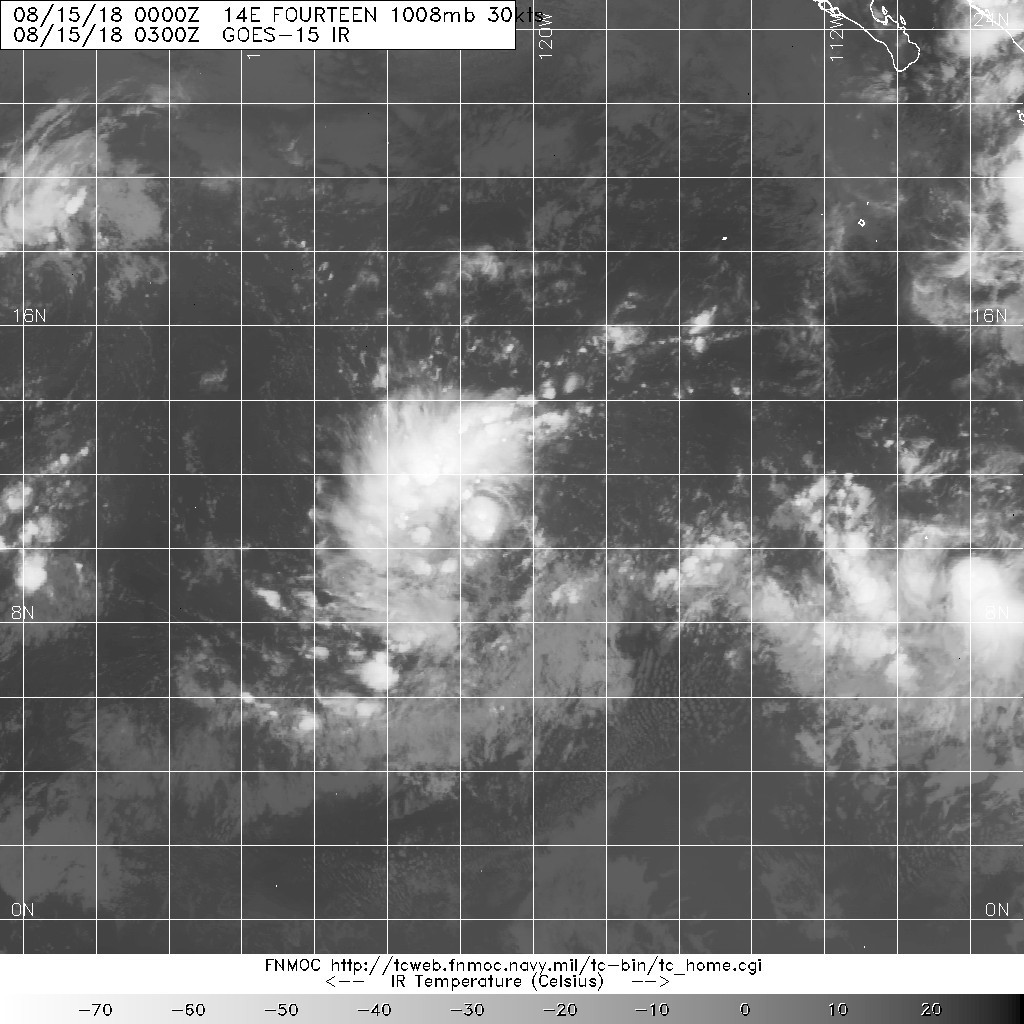
WTPZ44 KNHC 150238
TCDEP4

Tropical Depression Fourteen-E Discussion Number   1
NWS National Hurricane Center Miami FL       EP142018
800 PM PDT Tue Aug 14 2018

The area of disturbed weather and associated low pressure area that
the NHC has been tracking for the past few days has acquired enough
organized deep convection for the system to be declared a tropical
depression. Although the convection had waned a little during the
day, recent satellite imagery indicates that convection near the
well-defined center has begun to increase and that outer banding
features in the western semicircle have been improving during the
past few hours. The initial intensity of 30 kt is based on a Dvorak
satellite intensity estimate of T2.0/30 kt from TAFB.

The initial motion estimate is 265/12 kt. For the next 72 hours, the
tropical cyclone is forecast to move westward or slightly south of
due west along the southern periphery of a broad deep-layer ridge
that is located to the north of the depression. The ridge is
expected to weaken by 96 hours as a mid-latitude low/trough
currently located off the coast of southern California digs
southward and then westward during the forecast period. This
pattern should allow the cyclone to move west-northward into the
weakness in the ridge and start gaining latitude. For this initial
forecast of the system, the NHC track lies close to a blend of the
consensus track models HCCA and TVCE.

The vertical wind shear is forecast to remain around 10 kt or less
for the next 72 hours or so, with a further decrease on days 4 and 5
when the system moves underneath and/or develops an upper-level
anticyclone, conditions that typically favor significant
intensification. However, since the circulation envelope is
currently elongated northeast-to-southwest, it will take a couple of
days for the system to become more symmetrical, which could then
enhance the strengthening process. By that time, however, sea-
surface temperatures and mid-level humidity values will be marginal
for significant intensification to occur. As a result, only slow but
steady strengthening is indicated in this first intensity forecast,
which closely follows the HCCA intensity consensus model.

FORECAST POSITIONS AND MAX WINDS

INIT  15/0300Z 10.9N 121.2W   30 KT  35 MPH
12H  15/1200Z 10.8N 122.9W   35 KT  40 MPH
24H  16/0000Z 10.7N 125.2W   40 KT  45 MPH
36H  16/1200Z 10.8N 127.3W   45 KT  50 MPH
48H  17/0000Z 11.0N 129.5W   50 KT  60 MPH
72H  18/0000Z 12.0N 134.1W   65 KT  75 MPH
96H  19/0000Z 13.8N 138.6W   80 KT  90 MPH
120H  20/0000Z 15.6N 142.8W   90 KT 105 MPH

$$
Forecaster Stewart
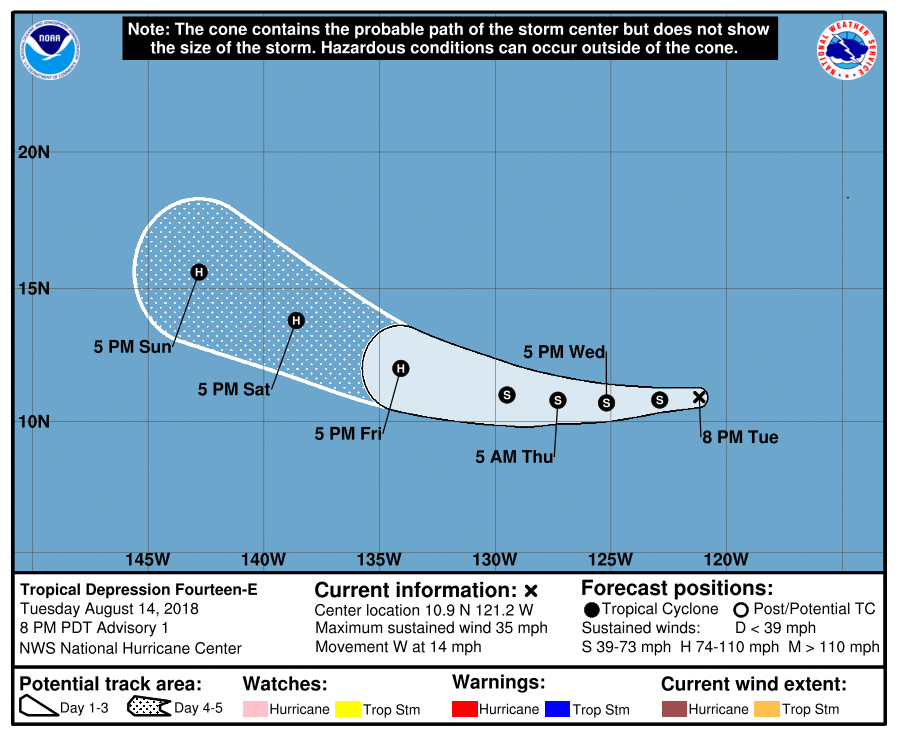
024005_5day_cone_no_line_and_wind.png 20180815.0300.goes-15.ir.14E.FOURTEEN.30kts.1008mb.11N.120.6W.100pc.jpg avn-animated (4).gif


點評

有機會到西太平洋嗎?  詳情 回復 發表於 2018-8-15 19:42
回復

使用道具 舉報

簽到天數: 601 天

[LV.9]以壇為家II

霧峰追風者|2018-8-15 03:14 | 顯示全部樓層
NHC 展望提升至80%,穩定西行。
1. A well-defined low pressure system is located just over 1000 miles
southwest of the southern tip of the Baja California peninsula.
Showers and thunderstorms continue to become better organized, and a
tropical depression is likely to form tonight or Wednesday while the
disturbance moves westward at 10 to 15 mph.
* Formation chance through 48 hours...high...80 percent.
* Formation chance through 5 days...high...90 percent.

two_pac_2d1.png 20180814.1414.f18.ir.olsircomp.97E.INVEST.x.jpg rgb_lalo-animated.gif
回復

使用道具 舉報

簽到天數: 601 天

[LV.9]以壇為家II

霧峰追風者|2018-8-14 14:55 | 顯示全部樓層
JTWC 06Z發布TCFA,NHC 展望提升至60%,穩定西移,後期有機會進入中太。
1. A large low pressure system is located about 950 miles southwest of
the southern tip of the Baja California peninsula. Shower and
thunderstorm activity continues to become better organized, and
environmental conditions are expected to be conducive for a tropical
depression to form during the next couple of days days while the
disturbance moves westward at 10 to 15 mph.
* Formation chance through 48 hours...medium...60 percent.
* Formation chance through 5 days...high...90 percent.
two_pac_2d1.png ep972018.20180814061531.gif 20180814.0630.goes-15.ir.97E.INVEST.25kts.1009mb.11.5N.118.3W.100pc.jpg 97E_gefs_latest.png 97E_intensity_latest.png

回復

使用道具 舉報

123
快速回覆
您需要登錄後才可以回帖 登錄 | 立即加入

本版積分規則

本平台僅供學術討論之用,預報應以氣象局為準

威普網站虛擬主機贊助公司

臺灣第一個天氣類型社群平台 即時天氣資訊、精準颱風動態

線上客服
FB傳送訊息
廣告行銷
精準行銷 物超所值
官方粉專
發佈 快速回復 返回頂部 返回列表