Post-Tropical Cyclone Helene Discussion Number 37
NWS National Hurricane Center Miami FL AL082018
1100 AM AST Sun Sep 16 2018
Helene's cloud pattern has transformed into that of an
extratropical cyclone, with a large area of cold cloud tops
located well to the north and northwest of the center. An ASCAT
pass that caught the eastern portion of the circulation revealed
maximum winds of 40 to 45 kt, therefore the initial wind speed
remains 45 kt for this advisory. The global models suggest that
the system will strengthen slightly today due to baroclinic
processes, and this is reflected in the official forecast.
Weakening is anticipated by late Monday, and the system is forecast
to be absorbed by a larger low pressure to the northwest of the
United Kingdom by Tuesday morning.
The cyclone is moving quickly northeastward or 055/25 kt. Now that
the system is embedded within the mid-latitude westerlies, a
northeastward motion with some additional increase in forward speed
is expected over the next day or so. The global models remain in
good agreement on the track of the post-tropical low, and the new
official forecast is an update of the previous advisory.
This is the last NHC advisory on this system. Interests in Ireland
and the United Kingdom should consult products from their local
meteorological service for information about potential impacts from
the post-tropical cyclone. Local forecasts and warnings for the UK
can be found on the website of the UK Met Office at https://www.metoffice.gov.uk/. Local forecasts and warnings for
Ireland can be found on the website of Met Eireann
at https://www.met.ie/.
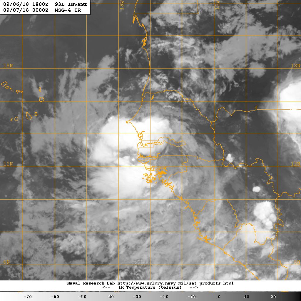
Potential Tropical Cyclone Eight Discussion Number 1
NWS National Hurricane Center Miami FL AL082018
1100 AM AST Fri Sep 07 2018
Satellite imagery and surface observations indicate that the area of
low pressure that moved off the west coast of Africa has developed a
closed circulation that appears to be well defined. However, the
convective organization, given Dvorak classifications of only T1.0,
do not support calling the system a tropical cyclone at this point.
However, given that the system is expected to be a tropical storm
near the southern Cabo Verde Islands in 36 to 48 hours, advisories
are being initiated on this system as a potential tropical cyclone
at this time, and a tropical storm warning has been issued for those
islands.
Environmental conditions of light to moderate easterly shear and
SSTs of 27-28C should support development of this system, and the
NHC forecast shows it becoming a tropical storm by 12 hours.
Gradual strengthening is indicated by the bulk of the intensity
guidance through the next 3-4 days. After that time, the shear is
forecast to increase and the system will be moving into somewhat
cooler waters, so some weakening is expected by day 5. The NHC
forecast is close to the latest HCCA guidance and a little higher
than the IVCN consensus.
The initial motion estimate is a somewhat uncertain 275/09 given
that the surface circulation is just forming. The synoptic pattern
over the eastern Atlantic features a ridge to the north of the
disturbance, which is expected to weaken by the end of the period.
This steering pattern should result in a westward to west-
northwestward motion for the next 72 hours with an increase in
forward speed, followed by a decrease in forward speed and a
slightly more poleward motion as the system responds to the weakness
in the ridge. The initial NHC track forecast is close to the latest
HCCA track consensus aid and near the middle of the guidance
envelope.