簽到天數: 3279 天 [LV.Master]伴壇終老
|
 t02436|2016-7-24 11:40
|
顯示全部樓層
C1達成
000
WTPZ43 KNHC 240249
TCDEP3
HURRICANE GEORGETTE DISCUSSION NUMBER 10
NWS NATIONAL HURRICANE CENTER MIAMI FL EP082016
800 PM PDT SAT JUL 23 2016
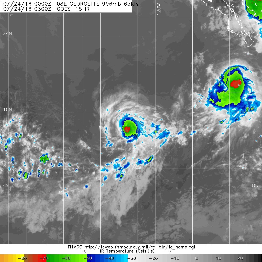
Georgette's convective structure improved this evening, as a band
of showers and thunderstorms wrapped more than 360 degrees around
the center. The intensity estimates spanned a wide range: 55 kt
from SAB Dvorak, 58 kt from CIMSS AMSU, 65 kt from TAFB Dvorak, and
75 kt from CIMSS ADT. A blend of these gives 65 kt, making
Georgette a hurricane. A 2227Z CIRA AMSU size analysis indicated
that the tropical cyclone remained small with tropical-storm-force
winds extending out only to 60 nm in the northern semicircle.
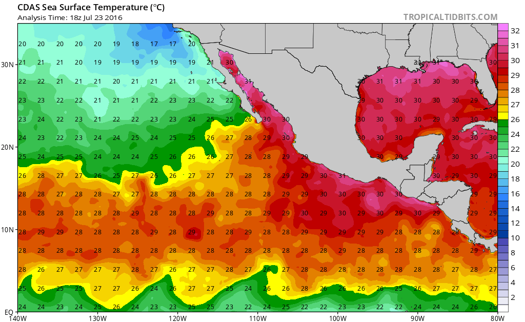
Continued steady intensification is expected, but only for another
day or so while Georgette traverses over warm SSTs, through moist
unstable air, and experiences low tropospheric vertical shear.
Starting on Monday, it is anticipated that the thermodynamics will
no longer be conducive and gradual to steady weakening should
occur. Around day four, the combination of cold SSTs and a dry
stable atmosphere may lead to the system losing its deep convection
and becoming a post-tropical cyclone. The NHC intensity forecast
shows a slightly higher peak intensity in a day, then indicates a
quicker demise. This forecast is based on a blend of the HWRF
dynamical hurricane model and the LGEM statistical technique.
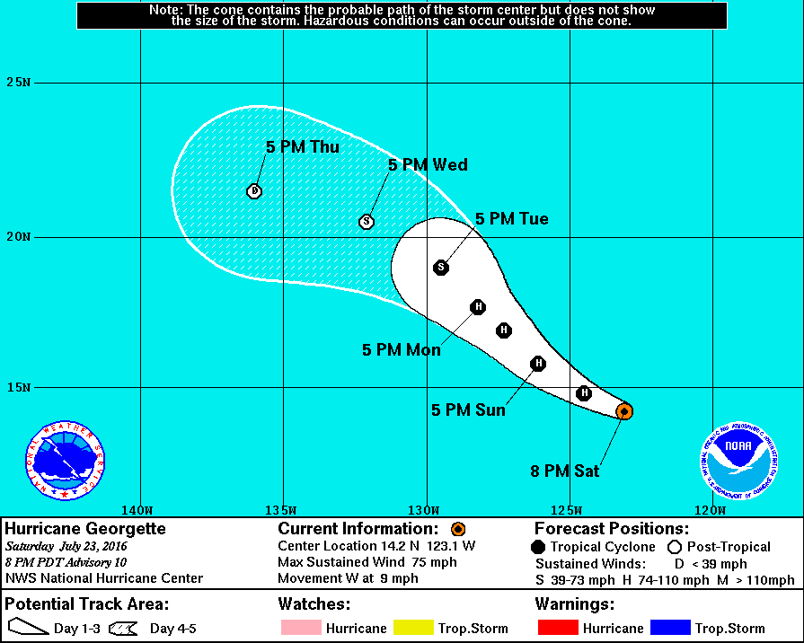
Georgette is moving toward the west at about 8 kt, in the mid-level
easterlies associated with the subtropical ridge to its north. An
upper-level low swings around to the western periphery of Georgette
and helps to induce a more northerly component of motion to the
hurricane between 36 and 72 h. By day four, a decaying Georgette is
steered back toward the west-northwest in the low-level trade winds.
The NHC track forecast is nearly the same as that from the previous
advisory and is based upon the TVCE multi-model consensus.
Georgette is the fourth hurricane to form during the month of July
in the eastern North Pacific basin. This ties a record for the
month of July, last equaled back in 1992.
FORECAST POSITIONS AND MAX WINDS
INIT 24/0300Z 14.2N 123.1W 65 KT 75 MPH
12H 24/1200Z 14.8N 124.5W 75 KT 85 MPH
24H 25/0000Z 15.8N 126.1W 80 KT 90 MPH
36H 25/1200Z 16.9N 127.3W 75 KT 85 MPH
48H 26/0000Z 17.7N 128.2W 70 KT 80 MPH
72H 27/0000Z 19.0N 129.5W 50 KT 60 MPH
96H 28/0000Z 20.5N 132.1W 35 KT 40 MPH...POST-TROPICAL
120H 29/0000Z 21.5N 136.0W 25 KT 30 MPH...POST-TROP/REMNT LOW
$$
Forecaster Landsea


|
|