開啟輔助訪問
 找回密碼
 立即加入

08E.Hilda 持續西行 逐漸減弱

簽到天數: 1650 天

[LV.Master]伴壇終老

老農民版夜神月|2021-8-5 05:02 | 顯示全部樓層
即將減弱為TD 203532_5day_cone_no_line_and_wind.png

000
WTPZ43 KNHC 042034
TCDEP3

Tropical Storm Hilda Discussion Number  21
NWS National Hurricane Center Miami FL       EP082021
200 PM PDT Wed Aug 04 2021

Convection associated with Hilda continues to weaken and shrink in
areal coverage due to modest northwesterly vertical wind shear,
sub-25C sea-surface temperatures (SSTs), and entrainment of stable,
cold-air stratocumulus clouds. A 1656Z partial ASCAT-A scatterometer
pass revealed two 33-kt vectors in the southeastern quadrant in the
radius-of-maximum winds. Even allowing for some undersampling, this
indicates that Hilda is barely hanging on to tropical storm status,
and the initial intensity will remain at 35 kt for this advisory.

Model analyses show virtually no instability in the center of and
north of Hilda right now, and with the cyclone forecast to move over
even cooler water and into increasing westerly wind shear during the
next 12-24 hours, a rapid decrease in both the convection and
cyclone's intensity appears to be forthcoming soon. Hilda is
forecast to become a depression later tonight and a remnant low
on Thursday. Dissipation is expected by late Friday or Saturday
well to the east of the Hawaiian Islands. The latest NHC official
intensity forecast is similar to the previous advisory, and follows
a blend of the HCCA and IVCN consensus intensity models.

Hilda continues on a steady west-northwestward course or 295/08 kt.
This general motion is expected to continue into  Thursday,
followed by a more westward motion on Friday and Saturday as a low-
to mid-level ridge builds to north of Hilda on days 2 and 3. The
official NHC track forecast is essentially just an update of
the previous advisory track, and lies along the southern edge of
the guidance envelope between the tightly packed consensus track
models to the north and the ECMWF model to the south.


FORECAST POSITIONS AND MAX WINDS

INIT  04/2100Z 19.4N 128.0W   35 KT  40 MPH
12H  05/0600Z 20.0N 129.4W   30 KT  35 MPH
24H  05/1800Z 21.0N 131.4W   25 KT  30 MPH
36H  06/0600Z 21.8N 133.7W   25 KT  30 MPH...POST-TROP/REMNT LOW
48H  06/1800Z 22.4N 136.1W   20 KT  25 MPH...POST-TROP/REMNT LOW
60H  07/0600Z 23.0N 138.4W   20 KT  25 MPH...POST-TROP/REMNT LOW
72H  07/1800Z...DISSIPATED

$$
Forecaster Stewart
20210804.1640.goes-17.vis.2km.08E.HILDA.35kts.1005mb.18.9N.127W.pc.jpg GOES20502021216EzgePu.jpg
回復

使用道具 舉報

簽到天數: 1650 天

[LV.Master]伴壇終老

老農民版夜神月|2021-8-6 01:25 | 顯示全部樓層
NHC降格TD 143506_5day_cone_no_line_and_wind.png 20210805.1640.goes-17.vis.2km.08E.HILDA.30kts.1006mb.20.7N.129.7W.pc.jpg
20210805.1550.f17.ir.olsircomp.08E.HILDA.x.jpg

965
WTPZ43 KNHC 051434
TCDEP3

Tropical Depression Hilda Discussion Number  24
NWS National Hurricane Center Miami FL       EP082021
800 AM PDT Thu Aug 05 2021

After an earlier brief burst of thunderstorm activity northeast of
the center around 0600Z, associated convection since then has been
on a rapid decline and warming of the cloud tops which now barely
reach -30 deg C near the center. The initial intensity has been
lowered to 30 kt based on a blend of Dvorak T- and CI-numbers of
T2.5 and T1.5 from both TAFB and SAB, and an objective satellite
intensity estimate of 2.0/30 kt from UW-CIMSS ADT, making Hilda a
tropical depression. Further weakening is expected now that Hilda is
located over sub-23 deg C sea-surface temperatures and moving into a
drier and more stable air mass. The cyclone is forecast to
degenerate into a remnant low later today and open up into a trough
by the weekend, well east of the Hawaiian Islands.

The initial motion estimate is 305/11 kt, which is faster and a
little to the right of the previous advisory motion. This is likely
due to the low- and upper-level circulations having decoupled now,
owing to the lack of significant convection. The weakening cyclone
should be steered west-northwestward for the next 48 hours by a
sprawling subtropical ridge located to the north. The new NHC
forecast track is similar to the previous advisory track and lies
down the middle of the tightly packed consensus models.


FORECAST POSITIONS AND MAX WINDS

INIT  05/1500Z 21.0N 130.2W   30 KT  35 MPH
12H  06/0000Z 21.7N 131.8W   25 KT  30 MPH
24H  06/1200Z 22.5N 133.9W   25 KT  30 MPH...POST-TROP/REMNT LOW
36H  07/0000Z 23.2N 136.1W   20 KT  25 MPH...POST-TROP/REMNT LOW
48H  07/1200Z 23.9N 138.3W   15 KT  15 MPH...POST-TROP/REMNT LOW
60H  08/0000Z...DISSIPATED

$$
Forecaster Stewart

回復

使用道具 舉報

簽到天數: 1650 天

[LV.Master]伴壇終老

老農民版夜神月|2021-8-7 01:22 | 顯示全部樓層
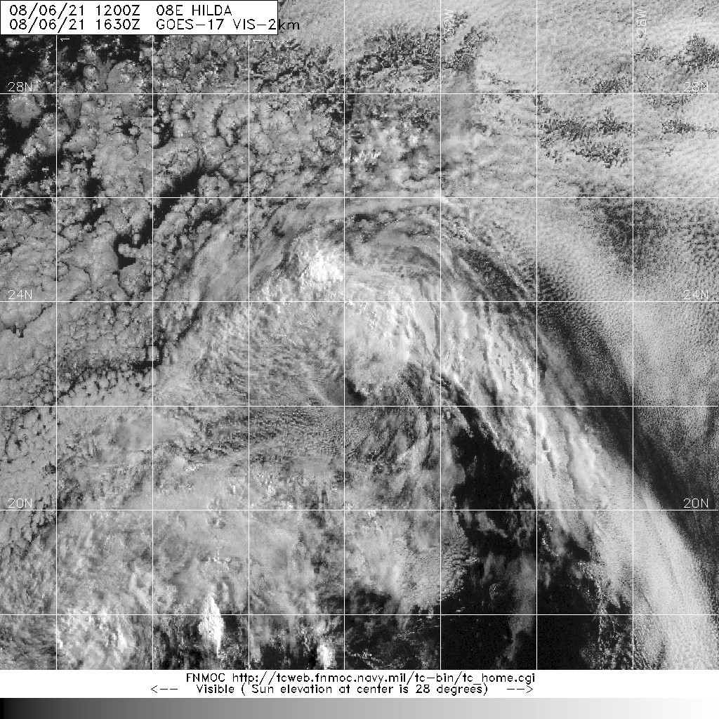
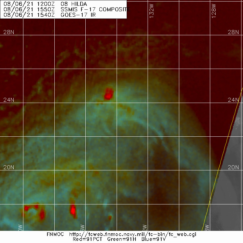
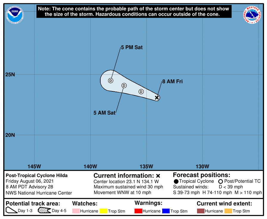
NHC停編08E 143708_5day_cone_no_line_and_wind.png 20210806.1630.goes-17.vis.2km.08E.HILDA.25kts.1008mb.22.9N.133.7W.pc.jpg
20210806.1550.f17.91pct91h91v.08E.HILDA.25kts.1008mb.22.9N.133.7W.095pc.jpg

000
WTPZ43 KNHC 061435
TCDEP3

Post-Tropical Cyclone Hilda Discussion Number  28
NWS National Hurricane Center Miami FL       EP082021
800 AM PDT Fri Aug 06 2021

Hilda has been devoid of organized deep convection for at least 12
hours, and since the cyclone is moving over sub-23C sea surface
temperatures, regeneration of deep convection is unlikely.  
Therefore, Hilda is designated as a 25 kt post-tropical remnant
low, and this is the last advisory from National Hurricane Center.  
The low should continue to move further into a dry and stable air
mass and over even cooler waters.  Consequently, weakening is
forecast and the remnant low of Hilda should open up into a trough
of low pressure over the weekend.

The initial motion is estimated to be west-northwestward, or 300/9
kt, and this general heading, within the low-level flow, is
forecast to continue until dissipation.

For additional information on Hilda please see High Seas Forecasts
issued by the National Weather service, under AWIPS header
NFDHSFEPI, WMO header FZPN02 KWBC, and on the web at
ocean.weather.gov/shtml/NFDHSFEPI.php


FORECAST POSITIONS AND MAX WINDS

INIT  06/1500Z 23.1N 134.1W   25 KT  30 MPH...POST-TROPICAL
12H  07/0000Z 23.6N 135.5W   25 KT  30 MPH...POST-TROP/REMNT LOW
24H  07/1200Z 24.1N 137.0W   20 KT  25 MPH...POST-TROP/REMNT LOW
36H  08/0000Z 24.5N 138.2W   20 KT  25 MPH...POST-TROP/REMNT LOW
48H  08/1200Z...DISSIPATED

$$
Forecaster Roberts

回復

使用道具 舉報

12
快速回覆
您需要登錄後才可以回帖 登錄 | 立即加入

本版積分規則

本平台僅供學術討論之用,預報應以氣象局為準

威普網站虛擬主機贊助公司

臺灣第一個天氣類型社群平台 即時天氣資訊、精準颱風動態

線上客服
FB傳送訊息
廣告行銷
精準行銷 物超所值
官方粉專
發佈 快速回復 返回頂部 返回列表