簽到天數: 4629 天 [LV.Master]伴壇終老
|
基本資料
編號 :94 L
擾動編號日期:2025 年 07 月 21 日 02 時
AL, 94, 2025072018, , BEST, 0, 92N, 456W, 25, 1011, LO, 34, NEQ,


Tropical Weather Outlook Text Tropical Weather Discussion
ZCZC MIATWOAT ALL
TTAA00 KNHC DDHHMM
Tropical Weather Outlook
NWS National Hurricane Center Miami FL
200 AM EDT Mon Jul 21 2025
For the North Atlantic...Caribbean Sea and the Gulf of America:
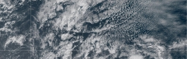
1. Central Tropical Atlantic (AL94):
Showers and thunderstorms associated with a small area of low
pressure located about 900 miles east-southeast of the Lesser
Antilles have increased some during the past several hours.
Environmental conditions are generally favorable for some additional
development over the next day or so while the system moves
west-northwestward at 10 to 15 mph. By the middle of this week,
environmental conditions are forecast to become unfavorable for
further development.
* Formation chance through 48 hours...low...20 percent.
* Formation chance through 7 days...low...20 percent.
Forecaster Hagen/Jelsema
|
評分
-
查看全部評分
|

 提升卡
提升卡 千斤頂
千斤頂 照妖鏡
照妖鏡


![91W JMA:TD[W] 熱帶低壓將通過台灣南部 留意大雨](data/attachment/block/f3/f36d9610a5027136e96e316fbd5a3bd4.jpg)