|
|
 krichard2011|2014-4-7 16:32
|
顯示全部樓層
krichard2011|2014-4-7 16:32
|
顯示全部樓層
補上完整報文
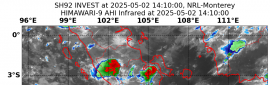
導引氣流不太明顯 過去移動速度2kt
幾乎近似滯留 該不會是想要原地增強...
IDQ20018
TROPICAL CYCLONE TECHNICAL BULLETIN: AUSTRALIA - EASTERN REGION
Issued by BRISBANE TROPICAL CYCLONE WARNING CENTRE
at: 0711 UTC 07/04/2014
Name: Tropical Cyclone Ita
Identifier: 15U
Data At: 0600 UTC
Latitude: 11.9S
Longitude: 153.3E
Location Accuracy: within 20 nm [35 km]
Movement Towards: northwest [324 deg]
Speed of Movement: 2 knots [5 km/h]
Maximum 10-Minute Wind: 50 knots [95 km/h]
Maximum 3-Second Wind Gust: 70 knots [130 km/h]
Central Pressure: 987 hPa
Radius of 34-knot winds NE quadrant: 70 nm [130 km]
Radius of 34-knot winds SE quadrant: 100 nm [185 km]
Radius of 34-knot winds SW quadrant: 120 nm [220 km]
Radius of 34-knot winds NW quadrant: 60 nm [110 km]
Radius of 48-knot winds NE quadrant: 30 nm [55 km]
Radius of 48-knot winds SE quadrant: 30 nm [55 km]
Radius of 48-knot winds SW quadrant: 30 nm [55 km]
Radius of 48-knot winds NW quadrant: 30 nm [55 km]
Radius of 64-knot winds:
Radius of Maximum Winds: 25 nm [45 km]
Dvorak Intensity Code: T3.5/3.5/D0.5/24HRS
Pressure of outermost isobar: 1004 hPa
Radius of outermost closed isobar: 150 nm [280 km]
FORECAST DATA
Date/Time : Location : Loc. Accuracy: Max Wind : Central Pressure
[UTC] : degrees : nm [km]: knots[km/h]: hPa
+06: 07/1200: 11.9S 153.0E: 030 [060]: 055 [100]: 983
+12: 07/1800: 11.8S 152.6E: 045 [080]: 060 [110]: 979
+18: 08/0000: 11.8S 152.1E: 055 [105]: 060 [110]: 980
+24: 08/0600: 11.7S 151.6E: 070 [130]: 065 [120]: 976
+36: 08/1800: 11.6S 150.3E: 090 [165]: 075 [140]: 969
+48: 09/0600: 11.7S 148.9E: 110 [200]: 080 [150]: 964
+60: 09/1800: 12.1S 147.3E: 130 [235]: 080 [150]: 965
+72: 10/0600: 12.5S 145.9E: 145 [270]: 080 [150]: 964
+96: 11/0600: 13.7S 143.4E: 190 [355]: 070 [130]: 973
+120: 12/0600: 15.1S 141.4E: 280 [515]: 040 [075]: 993
REMARKS:
The Dvorak analysis of was based on a curved band pattern in both Vis and IR over the past few images with an average of 0.85 degree wrap, giving a DT of 3.5. MET and PAT give 3.5. FT was based primarily on DT, but MET and PT support this in any case, supporting a cat 2, 50 knot system. This is qualitatively supported by recent microwave passes.
Tropical Cyclone Ita has become slow-moving in the past few hours under weak steering influences, however the mid level trough over the eastern Coral Sea should continue to move eastwards, allowing the mid-level ridge to develop to the southwest of Its. This should lead to the system resuming a general westwards track over the next few days under the influence of this mid-level ridge.
Vertical shear estimates from the AMSU instument suggested a consistent 15 to 20 knots of deep layer westerly shear over the system up until late yesterday, which was severely hampering development, and was conistent with the visual satellite presentation of the cyclone, with deep convection confined mainly to the southeast quadrant. However, in the past 12 to 18 hours, the AMSU indicates a significant reduction in vertical shear, which is also conistent with convection beginning to develop on the western flank. Thus, the system is coming into a favourable environment for further development with weak vertical wind shear expected to persist. Sea surface temperatures are greater than 27 degrees along most of its forecast track, although there is some reduction in ocean heat content, this should not prevent further intensification.
|
|