開啟輔助訪問
 找回密碼
 立即加入

01L.Arlene 高緯轉暖 北大西洋衛星時代第2個4月TS

簽到天數: 588 天

[LV.9]以壇為家II

Meow|2017-4-19 23:05 | 顯示全部樓層
本帖最後由 Meow 於 2017-4-19 23:18 編輯

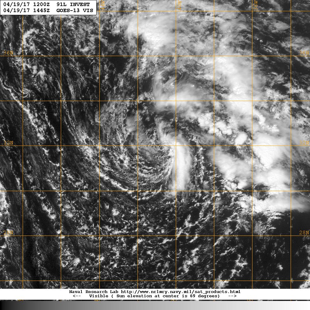
2003年Ana以來北大西洋首個4月熱帶或副熱帶氣旋,預計一天以後消散。
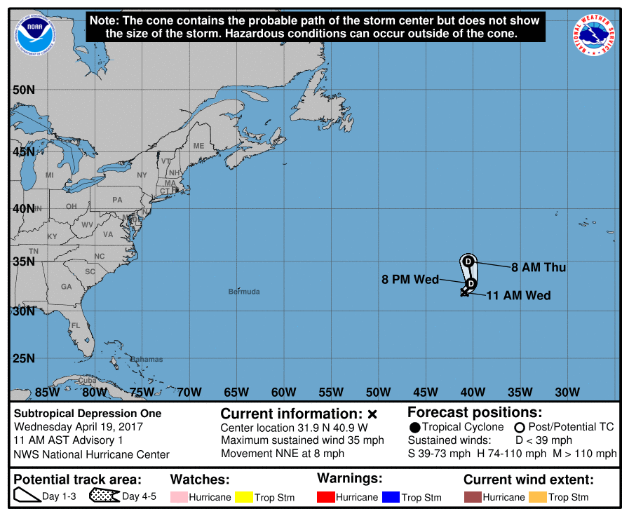
151126_5day_cone_with_line_and_wind.png
000
WTNT41 KNHC 191431
TCDAT1

Subtropical Depression One Discussion Number   1
NWS National Hurricane Center Miami FL       AL012017
1100 AM AST Wed Apr 19 2017

The non-tropical low over the north central Atlantic which has
been tracked by NHC for the past few days has developed organized
convection mainly in a curved band southeast of the center. The
system is still embedded within an upper-low, the outflow is minimal
and the strongest winds are removed from the center of circulation.
Consequently, the low is being classified as a subtropical
depression with an initial intensity of 30 kt. These winds are based
on recent ASCAT data. It is anticipated that shear and cold waters
will not allow intensification, and the subtropical depression is
expected to become absorbed by a large extratropical cyclone in
about 36 hours or sooner.

The subtropical depression is moving toward the north-northeast at
about 10 kt. A gradual turn to the north and north-northwest
around the approaching extratropical low is forecast for the next
24 hours or so.


FORECAST POSITIONS AND MAX WINDS

INIT  19/1500Z 31.9N  40.9W   30 KT  35 MPH
12H  20/0000Z 32.8N  40.2W   30 KT  35 MPH
24H  20/1200Z 35.0N  40.5W   30 KT  35 MPH
36H  21/0000Z...DISSIPATED

$$
Forecaster Avila
20170419.1445.goes13.x.vis1km.91LINVEST.30kts-995mb-316N-411W.100pc.jpg

評分

參與人數 1水氣能量 +20 收起 理由
ben811018 + 20

查看全部評分

回復

使用道具 舉報

簽到天數: 474 天

[LV.9]以壇為家II

劉瑞益@FB|2017-4-19 19:25 | 顯示全部樓層
提示: 作者被禁止或刪除 內容自動屏蔽
回復

使用道具 舉報

簽到天數: 3280 天

[LV.Master]伴壇終老

t02436|2017-4-18 09:31 | 顯示全部樓層
補充NHC評級資訊。
1. A non-tropical low pressure system located over the central Atlantic
about midway between Bermuda and the Azores Islands is producing an
area of gale-force winds to the west of the center.  This low is
currently producing only limited shower activity, but environmental
conditions could favor additional development and this system has
some potential to become a subtropical cyclone over the next day or
so as it moves generally eastward.  The next Special Tropical
Weather Outlook will be issued by 2 PM EDT Tuesday.  For additional
information on this system, please see High Seas Forecasts issued by
the National Weather Service.
* Formation chance through 48 hours...low...30 percent
* Formation chance through 5 days...low...30 percent

two_atl_2d0.png

91L_gefs_latest.png

rb-animated.gif

點評

似乎在持續減弱中,剩35kts992hpa,評價low  發表於 2017-4-19 14:39
回復

使用道具 舉報

12
快速回覆
您需要登錄後才可以回帖 登錄 | 立即加入

本版積分規則

本平台僅供學術討論之用,預報應以氣象局為準

威普網站虛擬主機贊助公司

臺灣第一個天氣類型社群平台 即時天氣資訊、精準颱風動態

線上客服
FB傳送訊息
廣告行銷
精準行銷 物超所值
官方粉專
發佈 快速回復 返回頂部 返回列表