|
|
本帖最後由 Meow 於 2017-4-21 04:50 編輯


ZCZC MIATCDAT1 ALL
TTAA00 KNHC DDHHMM
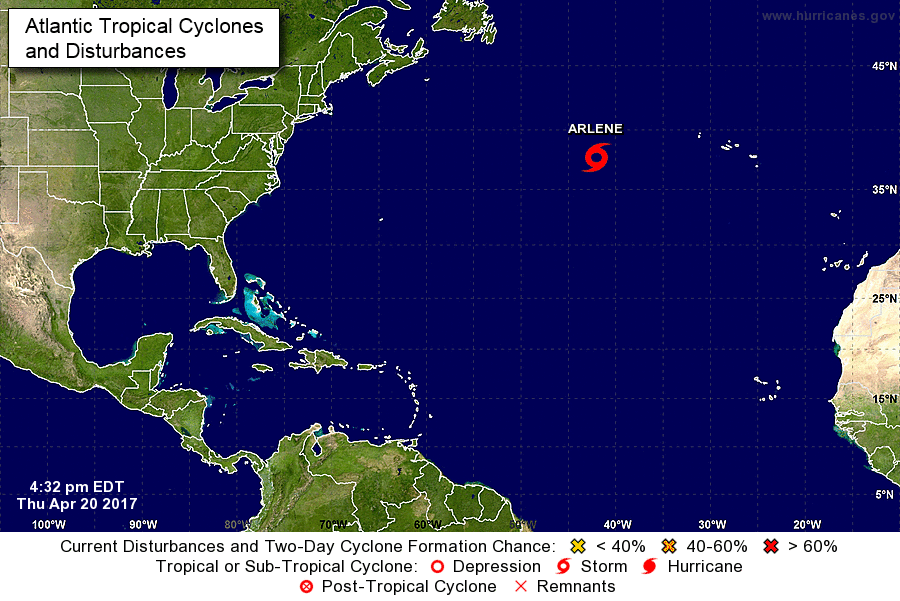
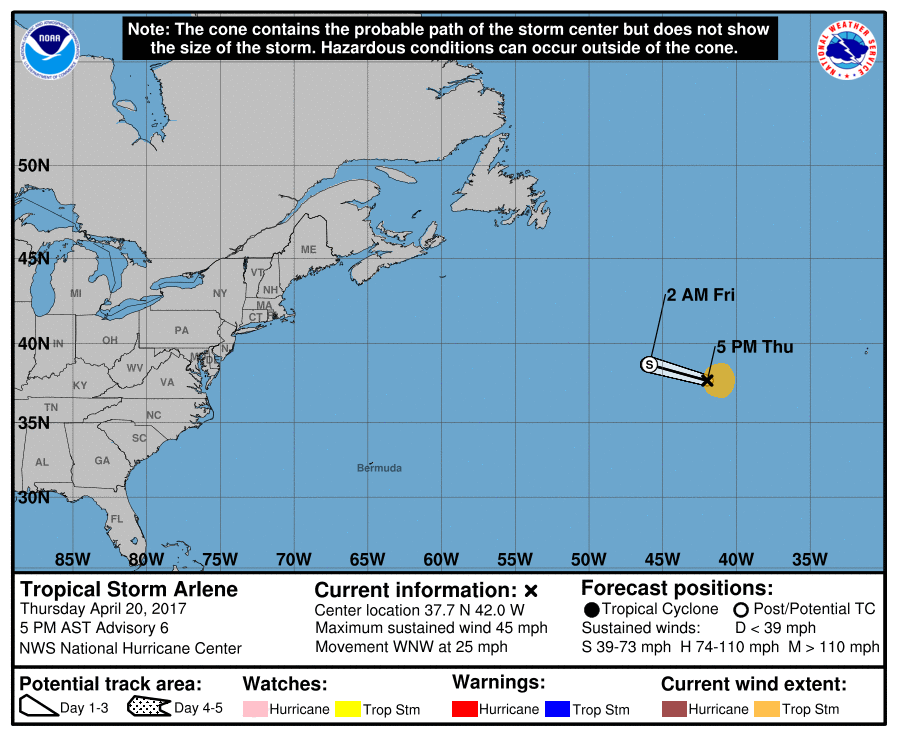
Tropical Storm Arlene Discussion Number 6
NWS National Hurricane Center Miami FL AL012017
500 PM AST Thu Apr 20 2017
I have to add one more surprise to my long hurricane forecasting
career. Unexpectedly, the subtropical cyclone became a tropical
depression this morning, and then it intensified to a tropical
storm. This intensity estimate is based on the cloud pattern
presentation on satellite imagery which shows moderate thunderstorm
activity surrounding an eye-type feature, and a convective ring in
microwave imagery. Initial intensity is set at 40 kt, although
estimates from TAFB suggest that the winds could have reached 45 kt
around 1800 UTC. Since that time, the cloud pattern has deteriorated
somewhat and winds probably have diminished. Despite the
intensification, Arlene is still forecast by all global models to
become absorbed by a nearby developing extratropical cyclone on
Friday.
Arlene is moving toward the west-northwest at 22 kt, while well
embedded in the fast flow surrounding the extratropical low. This
general motion around the low is expected until dissipation on
Friday.
Tropical storms in April are rare and Arlene is only the second
one observed in this month during the satellite era. It should be
noted, however, that this type of storm was practically impossible
to detect prior to the weather satellite era.
FORECAST POSITIONS AND MAX WINDS
INIT 20/2100Z 37.7N 42.0W 40 KT 45 MPH
12H 21/0600Z 38.7N 45.9W 35 KT 40 MPH...POST-TROPICAL
24H 21/1800Z...DISSIPATED
$$
Forecaster Avila
NNNN |
|